Categorieën
Veilig online betalen
Betaal veilig via uw eigen bankomgeving
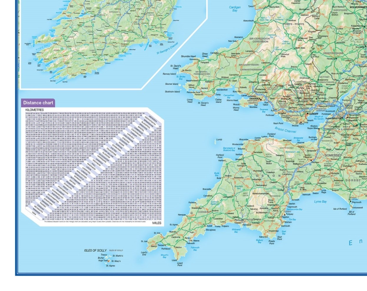
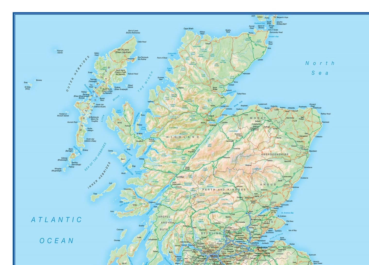
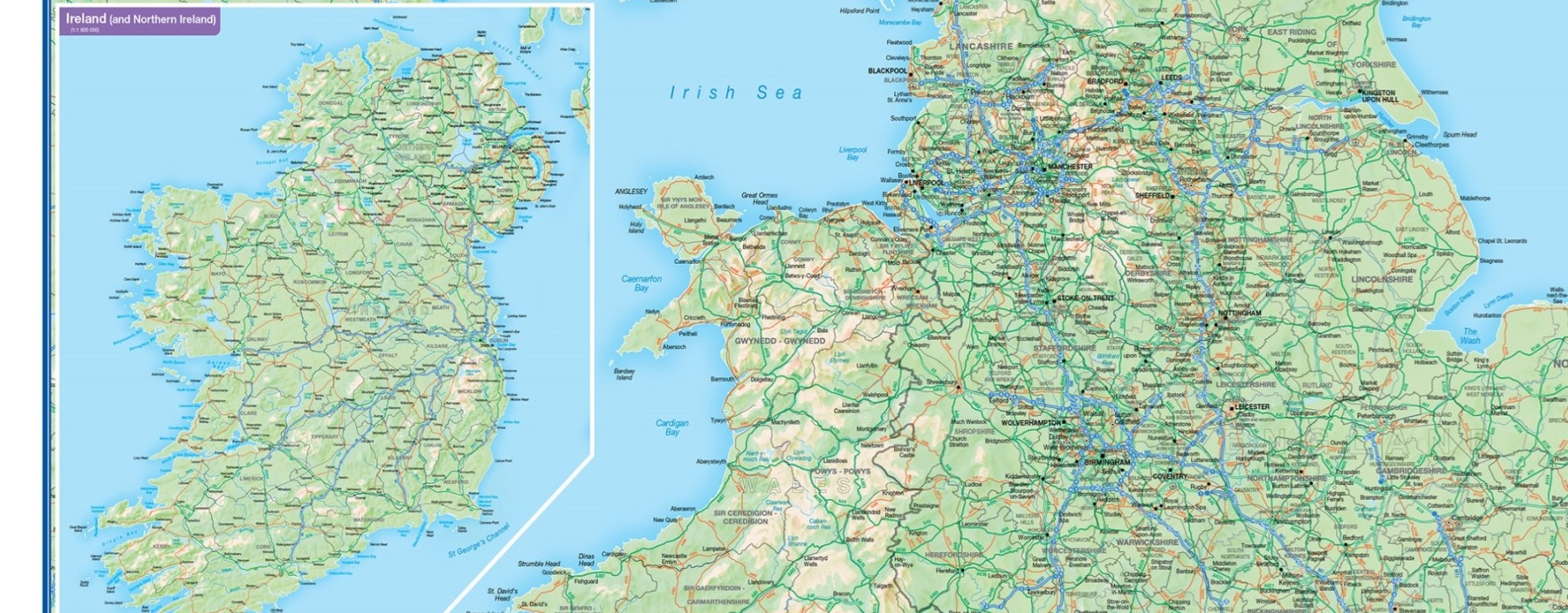
Wandkaart Engeland - British Isles roadplanning wall map, 84 X 119 cm | Maps International (9781904892663)
Geplastificeerd
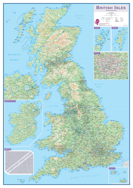
- ISBN / CODE: 9781904892663
- Editie: 2015
- Schaal: 1:850000
- Uitgever: Maps International
- Soort: Wandkaart van een land
- Taal: Engels
- Hoogte: 119.0 cm
- Breedte: 84.0 cm
- Uitvoering: Geplastificeerd
- Schrijf als eerste een review
-
€ 34,95
Leverbaar in 3 - 5 werkdagen in huis in Nederland Levertijd Belgie
Gratis verzending in Nederland vanaf €35,-


Beschrijving
Reviews
Geen reviews gevonden voor dit product.
Schrijf een review
Graag horen wij wat u van dit artikel vindt. Vindt u het goed, leuk, mooi, slecht, lelijk, onbruikbaar of erg handig: schrijf gerust alles op! Het is niet alleen leuk om te doen maar u informeert andere klanten er ook nog mee!
Ook interessant voor europa/engeland
-

Wegenkaart - landkaart Ireland - Ier
€ 14,50Wegenkaarten Ierland -

Wegenatlas Big Road Atlas Britain an
€ 20,95Wegenatlassen Noord Ierland -

Fietsgids Bikeline Eurovelo 1 - Atl
€ 17,95Fietsgidsen Engeland -

Fotoboek Wild Britain - Wild Ireland
€ 29,95Fotoboeken Engeland -

Scratch Map Bier Brouwerijen Groot-B
€ 16,95Scratch Maps & kraskaarten Wales