♦ Dartmoor National Park
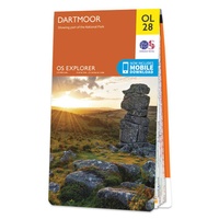 Wandelkaart - Topografische kaart OL28 OS Explorer Map Dartmoor | Ordnance Survey
Een van de beste detailkaarten die er op de wereld gemaakt worden: zeer gedetailleerd, prachtig helder kleurgebruik, veel topografische aspecten en - zeer belangrijk - allerlei toeristische en recreatieve aspecten …
★★★★★★★★★★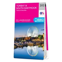 Wandelkaart - Topografische kaart 202 Landranger Torbay & South Dartmoor, Totnes & Salcombe | Ordnance Survey
Zeer goede detailkaart met topografische ondergrond. Kleurgebruik is goed over nagedacht: bijzonder goed leesbaar en helder kaartbeeld. Hierop zijn toeristische symbolen van bezienswaardigheden ingetekend, daarnaast staan bijvoorbeeld campings en jeugdherbergen …
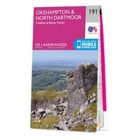 Wandelkaart - Topografische kaart 191 Landranger Okehampton & North Dartmoor | Ordnance Survey
Zeer goede detailkaart met topografische ondergrond. Kleurgebruik is goed over nagedacht: bijzonder goed leesbaar en helder kaartbeeld. Hierop zijn toeristische symbolen van bezienswaardigheden ingetekend, daarnaast staan bijvoorbeeld campings en jeugdherbergen …
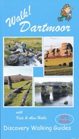 Wandelgids Walk! Dartmoor | Discovery Walking Guides
Engelstalige wandelgids voor Dartmoor, met uitgebreide beschrijvingen van wandelroutes, routekaartjes, praktische informatie zoals bussen en accommodatie. Kate and Alan Hobbs have reviewed and refreshed their Walk! Dartmoor classic guide book …
 Wandelgids Wild Swimming Walks Dartmoor and South Devon | Wild Things Publishing
The famous wild swimmers of Devon and Dartmoor share their favourite walks with a dip, featuring waterfalls, secret lakes, river meadows and sandy seaside secret beaches. Dartmoor and South Devon …
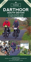 Fietskaart Cycling guides Dartmoor - South Devon | Goldeneye
Dartmoor. One of England’s greater National Parks; the Forest of Dartmoor covers 365 square miles and contains the highest ground in England south of the Peak District. On its desolate …
 Wandelgids Dartmoor walking and camping | Pesda Press
Dartmoor hovers at the edge of almost every Devon view, drawing the gaze up towards those high tor-encrusted open spaces. The pull is strong, and Tim Gent’s book is written …
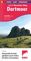 Wandelkaart Dartmoor | Harvey Maps
"This inspiring new map will help walkers and climbers explore Dartmoor's wild granite landscapes, and, like the granite, is virtually indestructible." Sir Ranulph Fiennes, adventurer and explorer. Dartmoor, the …
 Reisgids Devon Guide Book | Goldeneye
In this Devon guide book, which includes the Dartmoor and Exmoor National Parks, experienced West Country writer and photographer (and former Devon resident), William Fricker, provides his opinion on this …
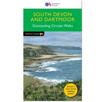 Wandelgids 001 Pathfinder Guides South Devon & Dartmoor | Ordnance Survey
Wandelgids van een deel van Engeland. Deze gids bevat 28 dagwandelingen, variërend van korte tochten tot pittige dagtochten. De bijbehorende kaarten zijn uitstekend: men heeft de topografische kaarten van Ordnance …
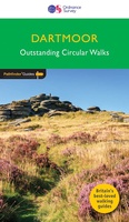 Wandelgids 026 Pathfinder Guides Dartmoor | Ordnance Survey
Wandelgids van een deel van Engeland. Deze gids bevat 28 dagwandelingen, variërend van korte tochten tot pittige dagtochten. De bijbehorende kaarten zijn uitstekend: men heeft de topografische kaarten van Ordnance …
★★★★★★★★★★ Wandelkaart Two Moors Way | Harvey Maps
Een bijzonder handige kaart van dit lange-afstands-wandelpad. Op waterafstotend papier met veel details. Het enige dat je eigenlijk een beetje mist is een overzicht. Verder uitstekend en voldoende voor de …
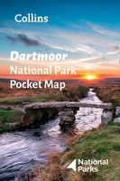 Wegenkaart - landkaart National Park Pocket Map Dartmoor | Collins
Handige kleine kaart van dit Nationaal Park. De kaart geeft een goed en helder overzicht van het gebied met alle plaatsen, doorgaande wandelpaden (alhoewel grof van schaal), bezienswaardigheden etc. Met …
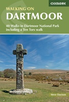 Wandelgids Walking on Dartmoor | Cicerone
A guidebook to 39 day walks and one two-day Ten Tors challenge across the Dartmoor National Park and its surrounding area. The guide contains low-level shorter walks and higher level …
 Fietskaart Dartmoor | Harvey Maps
New map for cycling on Dartmoor and the surrounding area. 2 maps in one: one side mountain biking the other side for cycle touring Tried and tested cycle …
 Wandelkaart Dartmoor Zuid | Harvey Maps
The whole of Dartmoor on two Maps. Dartmoor's famous Tors including Haytor Rocks and Yes Tor. The format gives more mapping on the sheet without making the map heavy and …
 Wandelkaart Dartmoor Noord | Harvey Maps
The whole of Dartmoor on two Maps. Dartmoor's famous Tors including Haytor Rocks and Yes Tor. The format gives more mapping on the sheet without making the map heavy and …
 Wandelkaart Dartmoor Noord | Harvey Maps
Covers a large area yet is handily compact. Pocket perfect! Detailed map for runners and walkers of the north section of Dartmoor National Park at the magic scale of …
 Wandelkaart Dartmoor Zuid | Harvey Maps
Covers a large area yet is handily compact. Pocket perfect! Detailed map for runners and walkers of the south section of Dartmoor National Park at the magic scale of …
 Wandelgids Walks Discovering Lesser Known Dartmoor | Matador
A guide describing routes of 1½ to 10 miles, enabling walkers to discover the beauty, history and hidden places of Dartmoor, the wildest, most remote and arguably the most beautiful …
Laatste reviews

Kan de huidige ontstuimige ontwikkelingen wereldwijd, nu ook geografisch plaatsen en daarmee beter volgen.
★★★★★ door Leo Janssen 20 december 2024 | Heeft dit artikel gekocht
We hadden Piëmonte al eens bezocht en voor onze komende reis werd ons door kennissen deze gids aanbevolen. Inderdaad is dit een heel goede gids. …
★★★★★ door DWKdB 19 december 2024 | Heeft dit artikel gekocht
Mijn bestellingen zijn altijd goed en worden altijd op tijd geleverd. Komen afspraken goed na. Erg tevreden.
★★★★★ door Ben Wegdam 19 december 2024 | Heeft dit artikel gekocht
Zeer gedetailleerde kaart van het zuidelijke deel van het douaniers pad
★★★★★ door Marian 18 december 2024 | Heeft dit artikel gekocht


