Boeken - South East England
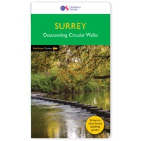 Wandelgids 065 Pathfinder Guides Surrey | Ordnance Survey
Fraaie, goed verzorgde wandelgidsjes met 28 wandelingen van max. een dag, (beginnend bij korte, eindigend bij langere wandelingen). Weergegeven op duidelijke topografische kaartjes (1:25.000). Bevat verder wetenswaardigheden en praktische informatie …
★★★★★ Wandelgids 50 Walks in Sussex and South Downs | AA Publishing
Uitstekende wandelgids met een aantal dagtochten tussen de 5 en 15 kilometer. Niet heel erg lang dus, maar wel op de mooiste plekken en goed beschreven en prima kaartmateriaal. A …
★★★★★ Reisgids Trotter Zuid Engeland | Lannoo
Veel aandacht voor praktische informatie als hotels en restaurants, maar ook beschrijvingen van bezienswaardigheden. Handig zijn de vele plattegronden: verrassend en verfrissend geschreven! Geen foto's. Een must voor elke reiziger …
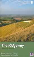 Wandelgids The Ridgeway - National Trail Guides | Aurum Press
Uitstekend routeboek met goede kaarten van Ordnance Survey. Praktische info voor overnachten enigzins beperkt achterin. The Ridgeway follows one of the oldest ‘green roads’ in Europe. It runs for 87 …
 Wandelgids North Downs Way national trail | Aurum Press
Goede engelstalige wandelgids van deze LAW in zuid oost Engeland, net onder Londen. Goede beschrijving en prima kaarten van Ordnance Survey, enigzins beperkte praktische tips, maar die zijn op de …
★★★★★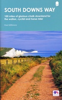 Wandelgids South Downs Way | Frances Lincoln
De officiële routegids: goede kaarten van Ordnance survey, schaal 1:25.000. Routebeschrijving behoorlijk uitgebreid. This is the complete, official guide by Paul Millmore for the long-distance walker or the weekend stroller. …
 Wandelgids Walking in the Thames Valley | Cicerone
Walking in the Thames Valley offers 25 challenging circular walks around the River Thames and River Kennet in the south of England, taking in the Southern Chilterns, the Berkshire and …
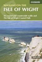 Wandelgids Walking on the Isle of Wight | Cicerone
34 walking routes on the beautiful Isle of Wight, ranging in difficulty from easy to strenuous and from 4 to 16 miles long. The routes are suitable for all abilities …
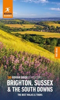 Reisgids Brighton, Sussex & the South Downs | Rough Guides
Een kleinere versie in zakformaat van de grotere versies van de Rough Guides. Als altijd weer vol met goede informatie over cultuur en praktische zaken. Voorin een kaart van de …
 Reisgids Slow Travel Isle of Wight | Bradt Travel Guides
Een bijzondere serie van Bradt guides, waarin een gedeelte van Engeland uitgebreid beschreven wordt. Met veelv aandacht voor kleine details die je niet ao gauw elders zult vinden. Naast de …
★★★★★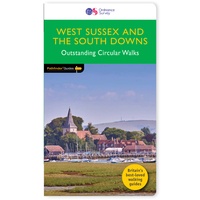 Wandelgids 066 Pathfinder Guides West Sussex and the South Downs National Park | Ordnance Survey
Wandelgids van een deel van Engeland. Deze gids bevat 28 dagwandelingen, variërend van korte tochten tot pittige dagtochten. De bijbehorende kaarten zijn uitstekend: men heeft de topografische kaarten van Ordnance …
 Fietsgids 20 Classic Sportives - South East England | Cicerone
This guidebook offers 20 sportive cycling routes in the best cycling areas of south east England. The training rides range between 60 and 117km (37 to 73 miles) in length, …
 Fietsgids Paris - Londre a velo, Parijs - Londen | Chamina
Fietsgids van een mooie route van Parijs naar Londen. Fraai geïllustreerde boekje (spiraalband). Het bevat naast duidelijke routekaartjes ook diverse praktische aanwijzingen voor onderweg, zoals adressen en telefoonnummers van campings …
 Wandelgids Walking The Thames Path: From the Sea to the Source | Cicerone
Engelstalige beschrijving van een van de mooiste wandeltochten in Engeland: een stuk boordevol cultuur en geschiedenis!. De gids voldoet aan alle verwachtingen die je kunt hebben. Met apart gidjes met …
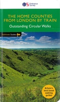 Wandelgids 072 Pathfinder Guides The Home Counties from London by Train | Ordnance Survey
The all-revised edition contains 27 carefully selected walks, all chosen to be easily accessible from London's main railway stations. The routes lie across Essex, Bedfordshire, Oxfordshire, Surrey, West Sussex, East …
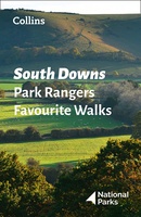 Wandelgids Park Rangers Favourite Walks South Downs | Collins
Compacte wandelgids met 20 wandelingen geselecteerd door park rangers en met duidelijke beschrijvingen en routekaartjes. Walking guide to the South Downs National Park, with 20 best routes chosen by …
 Reisgids Kent, Sussex & Surrey | Rough Guides
This Kent, Sussex & Surrey guidebook is perfect for independent travellers planning a longer trip. It features all of the must-see sights and a wide range of off-the-beaten-track places. It …
★★★★★ Reisgids Capitool Reisgidsen Zuid-Engeland | Unieboek
De Capitool Reisgids Zuid-Engeland helpt je bij het samenstellen van de perfecte reis. Deze reisgids verdeelt Zuid-Engeland in zes gebieden: Londen, Kent en Sussex, Hampshire en Wiltshire, Dorset en Somerset, …
★★★★★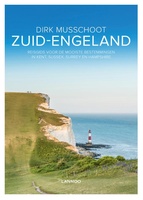 Reisgids Zuid Engeland | Lannoo
Maak op een onovertroffen wijze kennis met de regio's Kent, East & West Sussex, Surrey, Hampshire en het eiland Wight, en de bestemmingen die je daar absoluut niet mag missen. …
 Reisgids Marco Polo NL Zuid England | 62Damrak
Marco Polo reisgids voor Zuid-Engeland. Handig pocketformaat, boordevol informatie, met uitneembare kaart achter in het boek en atlas-pagina’s. Met Insider Tips om de échte stad/streek te ontdekken en de TOP …
- 1
- 2
- 3
- Volgende >>
- 4
Laatste reviews

Kan de huidige ontstuimige ontwikkelingen wereldwijd, nu ook geografisch plaatsen en daarmee beter volgen.
★★★★★ door Leo Janssen 20 december 2024 | Heeft dit artikel gekocht
We hadden Piëmonte al eens bezocht en voor onze komende reis werd ons door kennissen deze gids aanbevolen. Inderdaad is dit een heel goede gids. …
★★★★★ door DWKdB 19 december 2024 | Heeft dit artikel gekocht
Mijn bestellingen zijn altijd goed en worden altijd op tijd geleverd. Komen afspraken goed na. Erg tevreden.
★★★★★ door Ben Wegdam 19 december 2024 | Heeft dit artikel gekocht
Zeer gedetailleerde kaart van het zuidelijke deel van het douaniers pad
★★★★★ door Marian 18 december 2024 | Heeft dit artikel gekocht


