Categorieën
Veilig online betalen
Betaal veilig via uw eigen bankomgeving
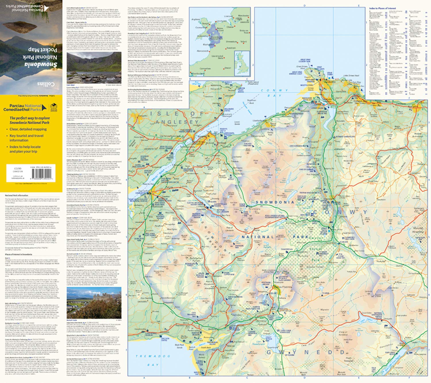
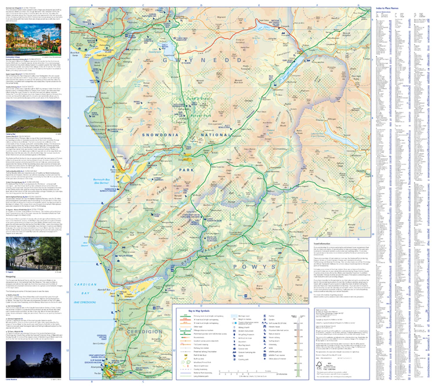
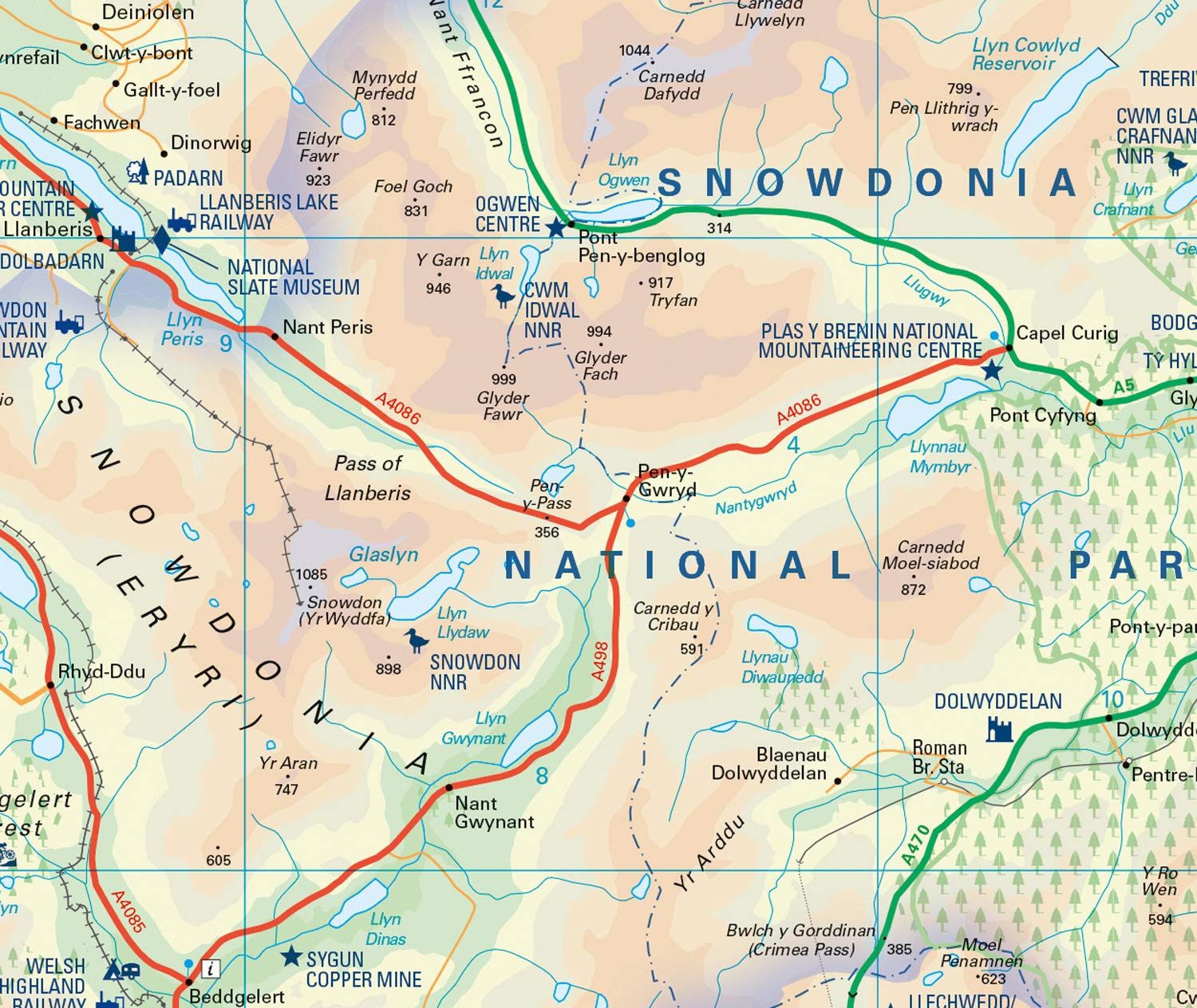
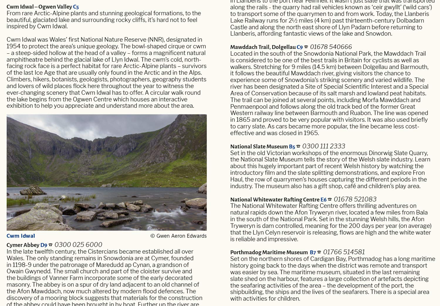
Wegenkaart - landkaart National Park Pocket Map Snowdonia | Collins (9780008439224)

- ISBN / CODE: 9780008439224
- Editie: 2022
- Schaal: 1:119000
- Uitgever: Collins
- Soort: Wegenkaart
- Serie: National Park Pocket Map
- Taal: Engels
- Uitvoering: Papier
- Bindwijze: -
- Schrijf als eerste een review
-
€ 7,95
Op voorraad. Voor 17.00 uur op werkdagen besteld, morgen in huis in Nederland Levertijd Belgie
Gratis verzending in Nederland vanaf €35,-
Beschrijving
- Clear, detailed mapping
- Key park, tourist and travel information
- Ideal for planning visits to the National Park
- Index to help locate and plan your trip
- Information on historic railways, stargazing, mountain biking and places of interest
Reviews
Geen reviews gevonden voor dit product.
Schrijf een review
Graag horen wij wat u van dit artikel vindt. Vindt u het goed, leuk, mooi, slecht, lelijk, onbruikbaar of erg handig: schrijf gerust alles op! Het is niet alleen leuk om te doen maar u informeert andere klanten er ook nog mee!
Ook interessant voor europa/engeland/wales
-

Wandelgids Great Mountain Days in Sn
€ 26,50Wandelgidsen Wales -

Wandelkaart - Topografische kaart 17
€ 19,50Topografische kaarten Wales -

Wandelgids Day Walks in Snowdonia |
€ 20,95Wandelgidsen West Midlands -

Reisgids Snowdonia & North Wales | R
€ 13,95Reisgidsen Wales -

Wegenkaart - landkaart National Park
€ 7,95Wegenkaarten Wales