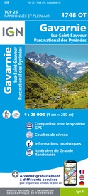
Wandelkaart - Topografische kaart 1748OT Gavarnie | IGN - Institut Géographique National (9782758551867)
P.N. des Pyrénées – Barèges – Luz-St.-Sauveur – Cirque de Gavarnie Pyreneeën
- ISBN / CODE: 9782758551867
- Editie: 07-02-2022
- Druk: 7
- Aantal blz.: 1
- Schaal: 1:25000
- Uitgever: IGN - Institut Géographique National
- Soort: Topografische kaart, Wandelkaart
- Serie: Top 25
- Taal: Frans
- Hoogte: 24.0 cm
- Breedte: 11.0 cm
- Gewicht: 93.0 g
- Uitvoering: Papier
- Bindwijze: -
- Beoordeling: 4,5 ★★★★★ ★★★★★ (2 reviews) Schrijf een review
-
€ 16,95
Op voorraad. Voor 17.00 uur op werkdagen besteld, binnen 1 tot 2 werkdagen in huis in Nederland Levertijd Belgie
Gratis verzending in Nederland vanaf €35,-
-
Topografische kaarten IGN 25.000 Pyreneeën : West

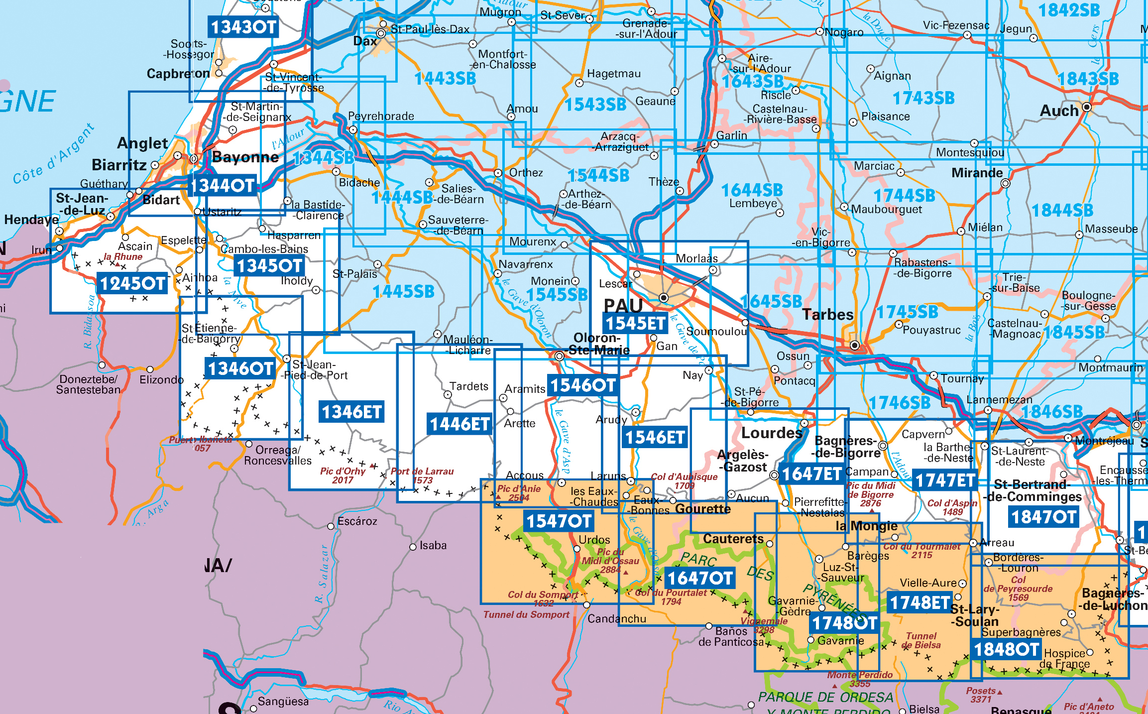
Producten op deze overzichtskaart:
Klik op een product om naar de pagina van dat product te gaan.
- Wandelkaart - Topografische kaart 1245OT Hendaye - St.Jean de Luz - Cote d'Argent | IGN - Institut Géographique National
- Wandelkaart - Topografische kaart 1343E SB - Serie Bleue Saint-Geours-de-Maremne | IGN - Institut Géographique National
- Wandelkaart - Topografische kaart 1344 SB - Serie Bleue Peyrehorade | IGN - Institut Géographique National
- Wandelkaart - Topografische kaart 1344OT Bayonne | IGN - Institut Géographique National
- Wandelkaart - Topografische kaart 1345OT Cambo-les-Bains – Hasparren | IGN - Institut Géographique National
- Topografische kaart - Wandelkaart 1346ET Forêt d'Iraty - Pic d'Orly | IGN - Institut Géographique National
- Topografische kaart - Wandelkaart 1346OT St.-Jean-Pied-de-Port | IGN - Institut Géographique National
- Wandelkaart - Topografische kaart 1444 SB - Serie Bleue Orthez | IGN - Institut Géographique National
- Wandelkaart - Topografische kaart 1445 SB - Serie Bleue Mauléon-Licharre – St-Palais | IGN - Institut Géographique National
- Wandelkaart - Topografische kaart 1446ET Tardets-Sorholus, Arette | IGN - Institut Géographique National
- Wandelkaart - Topografische kaart 1545 SB - Serie Bleue Oloron – Sainte-Marie | IGN - Institut Géographique National
- Wandelkaart - Topografische kaart 1545ET Pau | IGN - Institut Géographique National
- Wandelkaart - Topografische kaart 1546ET Laruns, Gourette | IGN - Institut Géographique National
- Wandelkaart - Topografische kaart 1546OT Oloron-Sainte.Marie, Vallee d'Aspe | IGN - Institut Géographique National
- Wandelkaart - Topografische kaart 1547OT Ossau - Vallée D'Aspe | IGN - Institut Géographique National
- Topografische kaart - Wandelkaart 1645 Pontacq - Ossun - Ger | IGN - Institut Géographique National
- Wandelkaart - Topografische kaart 1647ET Lourdes, Argeles-Gazost, Le Lavedan, Pierrefitte-Nestalas, Aucun | IGN - Institut Géographique National
- Wandelkaart - Topografische kaart 1647OT Vignemale, Ossau, Cauterets, Gourette | IGN - Institut Géographique National
- Wandelkaart - Topografische kaart 1745 SB - Serie Bleue Tarbes | IGN - Institut Géographique National
- Wandelkaart - Topografische kaart 1746 SB - Serie Bleue Bagnères-de-Bigorre | IGN - Institut Géographique National
- Wandelkaart - Topografische kaart 1747ET Bagnères-de-Bigorre | IGN - Institut Géographique National
- Wandelkaart - Topografische kaart 1748ET Neouvielle | IGN - Institut Géographique National
- Wandelkaart - Topografische kaart 1748OT Gavarnie | IGN - Institut Géographique National
- Wandelkaart - Topografische kaart 1845 SB - Serie Bleue Boulogne-sur-Gesse | IGN - Institut Géographique National
- Wandelkaart - Topografische kaart 1846 SB - Serie Bleue Lannemezan | IGN - Institut Géographique National
- Wandelkaart - Topografische kaart 1847OT Saint Bertrand de Comminges, Arreau | IGN - Institut Géographique National
- Wandelkaart - Topografische kaart 1848OT Bagnères de Luchon, | IGN - Institut Géographique National
- Wandelkaart - Topografische kaart 1848OTR Bagnères-de-Luchon | IGN - Institut Géographique National
-
Wandelkaarten IGN 25.000 Pyreneeën : West

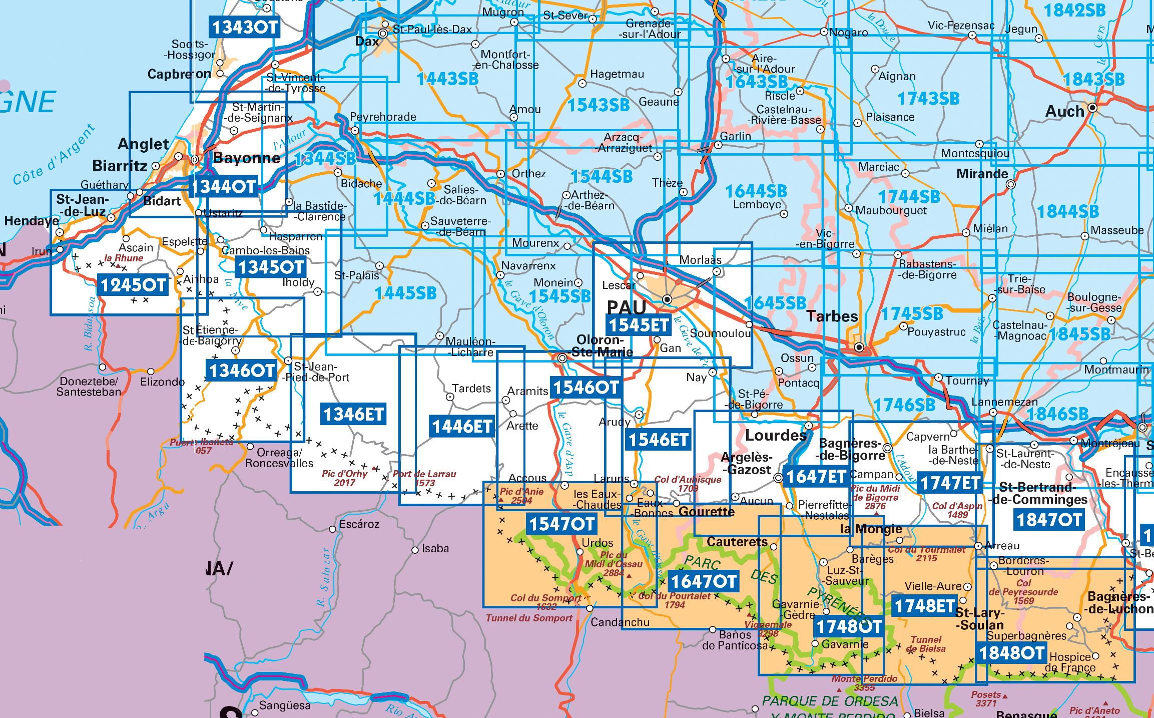
Producten op deze overzichtskaart:
Klik op een product om naar de pagina van dat product te gaan.
- Wandelkaart - Topografische kaart 1245OT Hendaye - St.Jean de Luz - Cote d'Argent | IGN - Institut Géographique National
- Wandelkaart - Topografische kaart 1343E SB - Serie Bleue Saint-Geours-de-Maremne | IGN - Institut Géographique National
- Wandelkaart - Topografische kaart 1344 SB - Serie Bleue Peyrehorade | IGN - Institut Géographique National
- Wandelkaart - Topografische kaart 1344OT Bayonne | IGN - Institut Géographique National
- Wandelkaart - Topografische kaart 1345OT Cambo-les-Bains – Hasparren | IGN - Institut Géographique National
- Topografische kaart - Wandelkaart 1346ET Forêt d'Iraty - Pic d'Orly | IGN - Institut Géographique National
- Topografische kaart - Wandelkaart 1346OT St.-Jean-Pied-de-Port | IGN - Institut Géographique National
- Wandelkaart - Topografische kaart 1444 SB - Serie Bleue Orthez | IGN - Institut Géographique National
- Wandelkaart - Topografische kaart 1445 SB - Serie Bleue Mauléon-Licharre – St-Palais | IGN - Institut Géographique National
- Wandelkaart - Topografische kaart 1446ET Tardets-Sorholus, Arette | IGN - Institut Géographique National
- Wandelkaart - Topografische kaart 1545 SB - Serie Bleue Oloron – Sainte-Marie | IGN - Institut Géographique National
- Wandelkaart - Topografische kaart 1545ET Pau | IGN - Institut Géographique National
- Wandelkaart - Topografische kaart 1546ET Laruns, Gourette | IGN - Institut Géographique National
- Wandelkaart - Topografische kaart 1546OT Oloron-Sainte.Marie, Vallee d'Aspe | IGN - Institut Géographique National
- Wandelkaart - Topografische kaart 1547OT Ossau - Vallée D'Aspe | IGN - Institut Géographique National
- Topografische kaart - Wandelkaart 1645 Pontacq - Ossun - Ger | IGN - Institut Géographique National
- Wandelkaart - Topografische kaart 1647ET Lourdes, Argeles-Gazost, Le Lavedan, Pierrefitte-Nestalas, Aucun | IGN - Institut Géographique National
- Wandelkaart - Topografische kaart 1647OT Vignemale, Ossau, Cauterets, Gourette | IGN - Institut Géographique National
- Wandelkaart - Topografische kaart 1745 SB - Serie Bleue Tarbes | IGN - Institut Géographique National
- Wandelkaart - Topografische kaart 1746 SB - Serie Bleue Bagnères-de-Bigorre | IGN - Institut Géographique National
- Wandelkaart - Topografische kaart 1747ET Bagnères-de-Bigorre | IGN - Institut Géographique National
- Wandelkaart - Topografische kaart 1748ET Neouvielle | IGN - Institut Géographique National
- Wandelkaart - Topografische kaart 1748OT Gavarnie | IGN - Institut Géographique National
- Wandelkaart - Topografische kaart 1845 SB - Serie Bleue Boulogne-sur-Gesse | IGN - Institut Géographique National
- Wandelkaart - Topografische kaart 1846 SB - Serie Bleue Lannemezan | IGN - Institut Géographique National
- Wandelkaart - Topografische kaart 1847OT Saint Bertrand de Comminges, Arreau | IGN - Institut Géographique National
- Wandelkaart - Topografische kaart 1848OT Bagnères de Luchon, | IGN - Institut Géographique National
- Wandelkaart - Topografische kaart 1848OTR Bagnères-de-Luchon | IGN - Institut Géographique National
Overzichtskaarten
Beschrijving
Van de uitgever
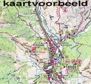
L'indispensable carte de randonnée IGN 1748OT. D'une très grande précision elle contient tous les détails existants sur le terrain : voies de communication jusqu'au moindre sentier, constructions jusqu'au hangar, bois, arbre isolé, rivière, source... Sans oublier la représentation du relief par des courbes de niveau. Les sentiers balisés et les informations touristiques sont également représentées.
Dit product heeft meerdere varianten:
Reviews
Ik wandel graag, zeker in berg regio's, dus deze kaart van de Gavarnie regio is erg nuttig. Het heeft veel details, is specifiek voor het wandelen en het is altijd leuk om naar te kijken om te leren hoe alle plekken heten! Het enige wat ik erbij mis is een goede plastic hoes: als je wandelt kan er wel eens een regenbij voorkomen, en dan wil je niet dat de kaart meteen nat wordt!
★★★★★ door Isabeau Ottolini 16 oktober 2018Vond u dit een nuttige review? (login om te beoordelen)
Uitstekende schaalverdeling, daardoor veel details.
★★★★★ door I.ten Have 24 februari 2015Vond u dit een nuttige review? (login om te beoordelen)
Schrijf een review
Graag horen wij wat u van dit artikel vindt. Vindt u het goed, leuk, mooi, slecht, lelijk, onbruikbaar of erg handig: schrijf gerust alles op! Het is niet alleen leuk om te doen maar u informeert andere klanten er ook nog mee!

