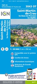
Topografische kaart - Wandelkaart 3043OT Saint-Martin-de-Crau | IGN - Institut Géographique National (9782758551560)
les Baux-de-Provence, les Alpilles
- ISBN / CODE: 9782758551560
- Editie: 31-05-2021
- Druk: 3
- Aantal blz.: 1
- Schaal: 1:25000
- Uitgever: IGN - Institut Géographique National
- Soort: Topografische kaart, Wandelkaart
- Serie: Top 25
- Taal: Frans
- Hoogte: 24.0 cm
- Breedte: 11.0 cm
- Gewicht: 93.0 g
- Bindwijze: -
- Uitvoering: Papier
- Beoordeling: 5,0 ★★★★★ (1 review) Schrijf een review
-
€ 16,95
Op voorraad. Voor 17.00 uur op werkdagen besteld, binnen 1 tot 2 werkdagen in huis in Nederland Levertijd Belgie
Gratis verzending in Nederland vanaf €35,-
-
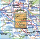
Topografische kaarten IGN 25.000 Provence en Cote d'Azur - WESTELIJK GEDEELTE
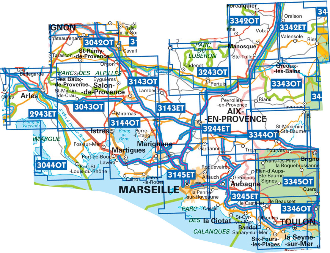
Producten op deze overzichtskaart:
Klik op een product om naar de pagina van dat product te gaan.
- Wandelkaart - Topografische kaart 2943ET Arles | IGN - Institut Géographique National
- Wandelkaart - Topografische kaart 3042OT Saint-Rémy-de-Provence | IGN - Institut Géographique National
- Topografische kaart - Wandelkaart 3043OT Saint-Martin-de-Crau | IGN - Institut Géographique National
- Wandelkaart - Topografische kaart 3044OT Port-Saint-Louis-du-Rhône | IGN - Institut Géographique National
- Wandelkaart - Topografische kaart 3143ET Aix-en-Provence | IGN - Institut Géographique National
- Wandelkaart - Topografische kaart 3143OT Salon-de-Provence | IGN - Institut Géographique National
- Wandelkaart - Topografische kaart 3144OT Étang de Berre | IGN - Institut Géographique National
- Wandelkaart - Topografische kaart 3145ET Marseille | IGN - Institut Géographique National
- Wandelkaart - Topografische kaart 3243OT Pertuis - Lourmarin | IGN - Institut Géographique National
- Wandelkaart - Topografische kaart 3244ET Montagne - Sainte-Victoire | IGN - Institut Géographique National
- Topografische kaart - Wandelkaart 3245ET Aubagne - La Ciotat | IGN - Institut Géographique National
- Wandelkaart - Topografische kaart 3342ET Plateau de Valensole | IGN - Institut Géographique National
- Wandelkaart - Topografische kaart 3342OT Manosque - Forcalquier | IGN - Institut Géographique National
- Wandelkaart - Topografische kaart 3343OT Gréoux-les-Bains - Rians | IGN - Institut Géographique National
- Wandelkaart - Topografische kaart 3344OT Saint-Maximin-la-Sainte-Baume | IGN - Institut Géographique National
- Wandelkaart - Topografische kaart 3345OT Signes – Tourves | IGN - Institut Géographique National
- Wandelkaart - Topografische kaart 3346OT Toulon | IGN - Institut Géographique National
-
Topografische kaarten IGN 25.000 Provence en Cote d'Azur - WESTELIJK GEDEELTE
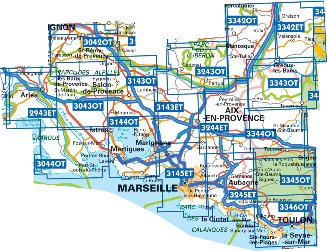
Producten op deze overzichtskaart:
Klik op een product om naar de pagina van dat product te gaan.
- Wandelkaart - Topografische kaart 2943ET Arles | IGN - Institut Géographique National
- Wandelkaart - Topografische kaart 3042OT Saint-Rémy-de-Provence | IGN - Institut Géographique National
- Topografische kaart - Wandelkaart 3043OT Saint-Martin-de-Crau | IGN - Institut Géographique National
- Wandelkaart - Topografische kaart 3044OT Port-Saint-Louis-du-Rhône | IGN - Institut Géographique National
- Wandelkaart - Topografische kaart 3143ET Aix-en-Provence | IGN - Institut Géographique National
- Wandelkaart - Topografische kaart 3143OT Salon-de-Provence | IGN - Institut Géographique National
- Wandelkaart - Topografische kaart 3144OT Étang de Berre | IGN - Institut Géographique National
- Wandelkaart - Topografische kaart 3243OT Pertuis - Lourmarin | IGN - Institut Géographique National
- Wandelkaart - Topografische kaart 3244ET Montagne - Sainte-Victoire | IGN - Institut Géographique National
- Topografische kaart - Wandelkaart 3245ET Aubagne - La Ciotat | IGN - Institut Géographique National
- Wandelkaart - Topografische kaart 3342ET Plateau de Valensole | IGN - Institut Géographique National
- Wandelkaart - Topografische kaart 3342OT Manosque - Forcalquier | IGN - Institut Géographique National
- Wandelkaart - Topografische kaart 3343OT Gréoux-les-Bains - Rians | IGN - Institut Géographique National
- Wandelkaart - Topografische kaart 3344OT Saint-Maximin-la-Sainte-Baume | IGN - Institut Géographique National
- Wandelkaart - Topografische kaart 3345OT Signes – Tourves | IGN - Institut Géographique National
- Wandelkaart - Topografische kaart 3346OT Toulon | IGN - Institut Géographique National
-
Wandelkaarten IGN 25.000 Provence en Cote d'Azur - WESTELIJK GEDEELTE
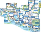
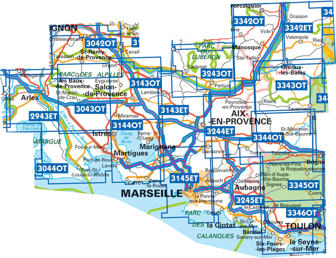
Producten op deze overzichtskaart:
Klik op een product om naar de pagina van dat product te gaan.
- Wandelkaart - Topografische kaart 2943ET Arles | IGN - Institut Géographique National
- Wandelkaart - Topografische kaart 3042OT Saint-Rémy-de-Provence | IGN - Institut Géographique National
- Topografische kaart - Wandelkaart 3043OT Saint-Martin-de-Crau | IGN - Institut Géographique National
- Wandelkaart - Topografische kaart 3044OT Port-Saint-Louis-du-Rhône | IGN - Institut Géographique National
- Wandelkaart - Topografische kaart 3143ET Aix-en-Provence | IGN - Institut Géographique National
- Wandelkaart - Topografische kaart 3143OT Salon-de-Provence | IGN - Institut Géographique National
- Wandelkaart - Topografische kaart 3144OT Étang de Berre | IGN - Institut Géographique National
- Wandelkaart - Topografische kaart 3145ET Marseille | IGN - Institut Géographique National
- Wandelkaart - Topografische kaart 3243OT Pertuis - Lourmarin | IGN - Institut Géographique National
- Wandelkaart - Topografische kaart 3244ET Montagne - Sainte-Victoire | IGN - Institut Géographique National
- Topografische kaart - Wandelkaart 3245ET Aubagne - La Ciotat | IGN - Institut Géographique National
- Wandelkaart - Topografische kaart 3342ET Plateau de Valensole | IGN - Institut Géographique National
- Wandelkaart - Topografische kaart 3342OT Manosque - Forcalquier | IGN - Institut Géographique National
- Wandelkaart - Topografische kaart 3343OT Gréoux-les-Bains - Rians | IGN - Institut Géographique National
- Wandelkaart - Topografische kaart 3344OT Saint-Maximin-la-Sainte-Baume | IGN - Institut Géographique National
- Wandelkaart - Topografische kaart 3345OT Signes – Tourves | IGN - Institut Géographique National
- Wandelkaart - Topografische kaart 3346OT Toulon | IGN - Institut Géographique National
-
Wandelkaarten IGN 25.000 Provence en Cote d'Azur - WESTELIJK GEDEELTE
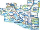
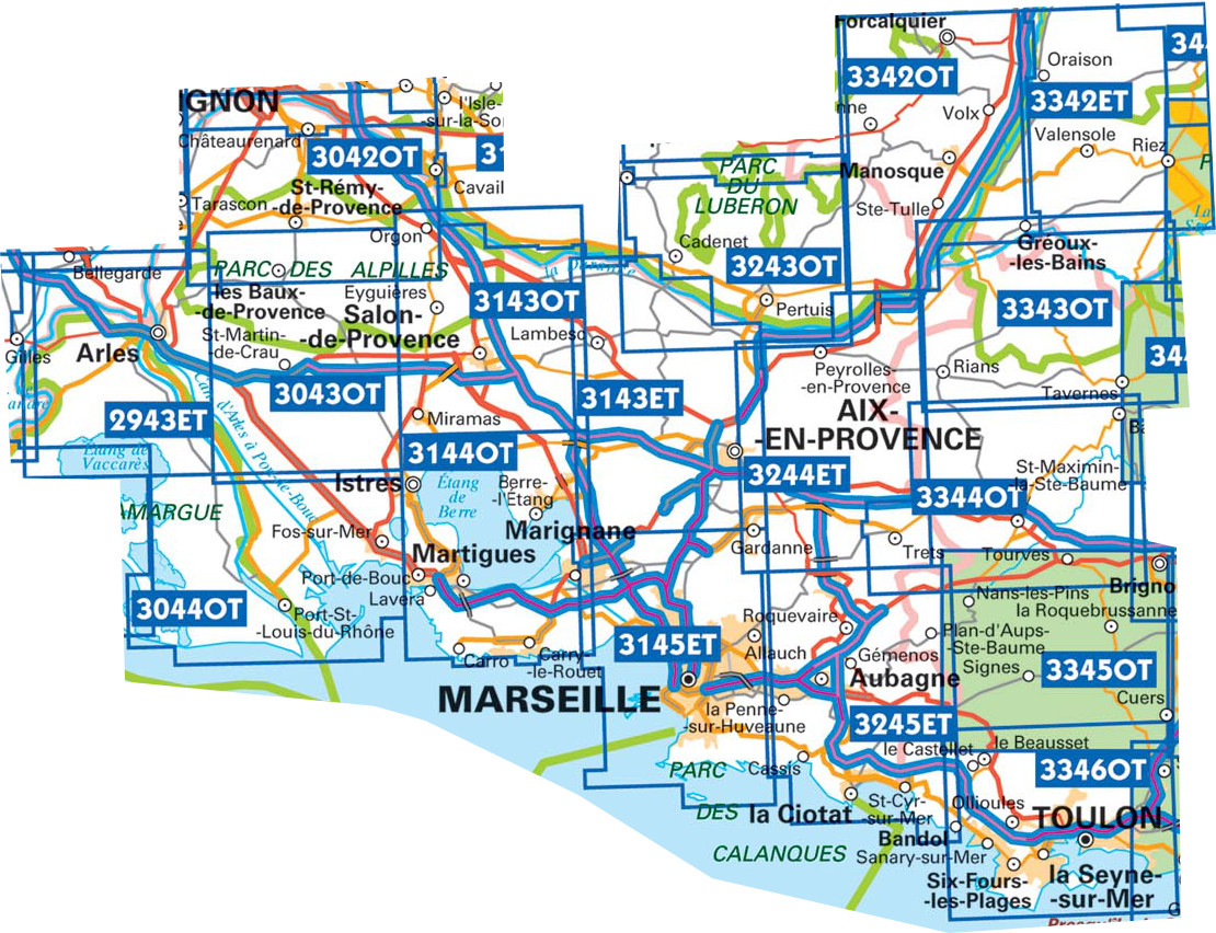
Producten op deze overzichtskaart:
Klik op een product om naar de pagina van dat product te gaan.
- Wandelkaart - Topografische kaart 2943ET Arles | IGN - Institut Géographique National
- Wandelkaart - Topografische kaart 3042OT Saint-Rémy-de-Provence | IGN - Institut Géographique National
- Topografische kaart - Wandelkaart 3043OT Saint-Martin-de-Crau | IGN - Institut Géographique National
- Wandelkaart - Topografische kaart 3044OT Port-Saint-Louis-du-Rhône | IGN - Institut Géographique National
- Wandelkaart - Topografische kaart 3143ET Aix-en-Provence | IGN - Institut Géographique National
- Wandelkaart - Topografische kaart 3143OT Salon-de-Provence | IGN - Institut Géographique National
- Wandelkaart - Topografische kaart 3144OT Étang de Berre | IGN - Institut Géographique National
- Wandelkaart - Topografische kaart 3145ET Marseille | IGN - Institut Géographique National
- Wandelkaart - Topografische kaart 3243OT Pertuis - Lourmarin | IGN - Institut Géographique National
- Wandelkaart - Topografische kaart 3244ET Montagne - Sainte-Victoire | IGN - Institut Géographique National
- Topografische kaart - Wandelkaart 3245ET Aubagne - La Ciotat | IGN - Institut Géographique National
- Wandelkaart - Topografische kaart 3342ET Plateau de Valensole | IGN - Institut Géographique National
- Wandelkaart - Topografische kaart 3342OT Manosque - Forcalquier | IGN - Institut Géographique National
- Wandelkaart - Topografische kaart 3343OT Gréoux-les-Bains - Rians | IGN - Institut Géographique National
- Wandelkaart - Topografische kaart 3344OT Saint-Maximin-la-Sainte-Baume | IGN - Institut Géographique National
- Wandelkaart - Topografische kaart 3345OT Signes – Tourves | IGN - Institut Géographique National
- Wandelkaart - Topografische kaart 3346OT Toulon | IGN - Institut Géographique National
Overzichtskaarten
Beschrijving
Reviews
De wandelingen met deze kaart staan gepland voor april, dus nog niet in de praktijk kunnen testen Eerder heb ik van jullie ook dit soort kaarten gekocht, die toen ook prima voldeden, o.a. omgeving Carcassonne en het land van de Katharen. Dus ik ga vol goede moed met dit materiaal op pad. Zeker omdat het goed klopt met mijn wandel-GPS (SatMap12) waarin hetzelfde kaartmateriaal als basis wordt getoond.
★★★★★ door Theo Boessenkool 17 februari 2022Vond u dit een nuttige review? (login om te beoordelen)
Schrijf een review
Graag horen wij wat u van dit artikel vindt. Vindt u het goed, leuk, mooi, slecht, lelijk, onbruikbaar of erg handig: schrijf gerust alles op! Het is niet alleen leuk om te doen maar u informeert andere klanten er ook nog mee!


