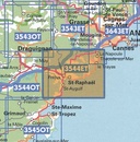
Topografische kaart - Wandelkaart 3544ET Fréjus - Saint-Raphaël | IGN - Institut Géographique National (9782758551980)
Corniche de l'Esterel
- ISBN / CODE: 9782758551980
- Editie: 07-02-2022
- Druk: 5
- Aantal blz.: 1
- Schaal: 1:25000
- Uitgever: IGN - Institut Géographique National
- Soort: Topografische kaart, Wandelkaart
- Serie: Top 25
- Taal: Frans
- Hoogte: 24.0 cm
- Breedte: 11.0 cm
- Gewicht: 88.0 g
- Bindwijze: -
- Uitvoering: Papier
- Beoordeling: 5,0 ★★★★★ (4 reviews) Schrijf een review
-
€ 16,95
Levertijd 2 - 4 werkdagen in huis in Nederland Levertijd Belgie
Gratis verzending in Nederland vanaf €35,-
-
Topografische kaarten IGN 25.000 Provence en Cote d'Azur - OOSTELIJK GEDEELTE

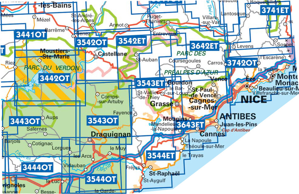
Producten op deze overzichtskaart:
Klik op een product om naar de pagina van dat product te gaan.
- Wandelkaart - Topografische kaart 3442OT Gorges du Verdon | IGN - Institut Géographique National
- Wandelkaart - Topografische kaart 3443OT Aups | IGN - Institut Géographique National
- Wandelkaart - Topografische kaart 3444OT Brignoles - le Luc | IGN - Institut Géographique National
- Wandelkaart - Topografische kaart 3445OT Cuers | IGN - Institut Géographique National
- Wandelkaart - Topografische kaart 3446ET Le Lavandou | IGN - Institut Géographique National
- Wandelkaart - Topografische kaart 3446OT Hyères | IGN - Institut Géographique National
- Wandelkaart - Topografische kaart 3542ET Haute Estéron | IGN - Institut Géographique National
- Wandelkaart - Topografische kaart 3542OT Castellane | IGN - Institut Géographique National
- Wandelkaart - Topografische kaart 3543ET Haute Siagne | IGN - Institut Géographique National
- Wandelkaart - Topografische kaart 3543OT Draguignan | IGN - Institut Géographique National
- Topografische kaart - Wandelkaart 3544ET Fréjus - Saint-Raphaël | IGN - Institut Géographique National
- Wandelkaart - Topografische kaart 3544OT le Muy – Lorgues | IGN - Institut Géographique National
- Wandelkaart - Topografische kaart 3545OT Saint-Tropez - Sainte-Maxime | IGN - Institut Géographique National
- Wandelkaart - Topografische kaart 3641OT Moyen Var | IGN - Institut Géographique National
- Wandelkaart - Topografische kaart 3642ET Vallée de l'Esteron | IGN - Institut Géographique National
- Wandelkaart - Topografische kaart 3643ET Cannes - Grasse | IGN - Institut Géographique National
- Wandelkaart - Topografische kaart 3741ET Vallée de la Bévera | IGN - Institut Géographique National
- Wandelkaart - Topografische kaart 3742OT Nice - Menton | IGN - Institut Géographique National
-
Topografische kaarten IGN 25.000 Provence en Cote d'Azur - OOSTELIJK GEDEELTE

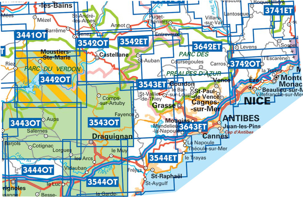
Producten op deze overzichtskaart:
Klik op een product om naar de pagina van dat product te gaan.
- Wandelkaart - Topografische kaart 3442OT Gorges du Verdon | IGN - Institut Géographique National
- Wandelkaart - Topografische kaart 3443OT Aups | IGN - Institut Géographique National
- Wandelkaart - Topografische kaart 3444OT Brignoles - le Luc | IGN - Institut Géographique National
- Wandelkaart - Topografische kaart 3445OT Cuers | IGN - Institut Géographique National
- Wandelkaart - Topografische kaart 3446ET Le Lavandou | IGN - Institut Géographique National
- Wandelkaart - Topografische kaart 3446OT Hyères | IGN - Institut Géographique National
- Wandelkaart - Topografische kaart 3542ET Haute Estéron | IGN - Institut Géographique National
- Wandelkaart - Topografische kaart 3542OT Castellane | IGN - Institut Géographique National
- Wandelkaart - Topografische kaart 3543ET Haute Siagne | IGN - Institut Géographique National
- Wandelkaart - Topografische kaart 3543OT Draguignan | IGN - Institut Géographique National
- Topografische kaart - Wandelkaart 3544ET Fréjus - Saint-Raphaël | IGN - Institut Géographique National
- Wandelkaart - Topografische kaart 3544OT le Muy – Lorgues | IGN - Institut Géographique National
- Wandelkaart - Topografische kaart 3545OT Saint-Tropez - Sainte-Maxime | IGN - Institut Géographique National
- Wandelkaart - Topografische kaart 3641OT Moyen Var | IGN - Institut Géographique National
- Wandelkaart - Topografische kaart 3642ET Vallée de l'Esteron | IGN - Institut Géographique National
- Wandelkaart - Topografische kaart 3643ET Cannes - Grasse | IGN - Institut Géographique National
- Wandelkaart - Topografische kaart 3741ET Vallée de la Bévera | IGN - Institut Géographique National
- Wandelkaart - Topografische kaart 3742OT Nice - Menton | IGN - Institut Géographique National
-
Wandelkaarten IGN 25.000 Provence en Cote d'Azur - OOSTELIJK GEDEELTE
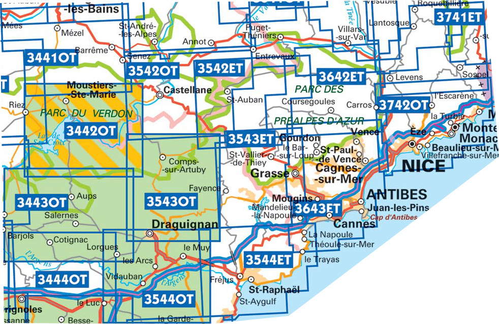

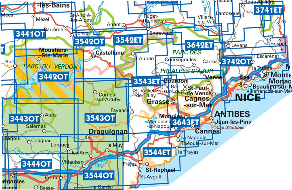
Producten op deze overzichtskaart:
Klik op een product om naar de pagina van dat product te gaan.
- Wandelkaart - Topografische kaart 3442OT Gorges du Verdon | IGN - Institut Géographique National
- Wandelkaart - Topografische kaart 3443OT Aups | IGN - Institut Géographique National
- Wandelkaart - Topografische kaart 3444OT Brignoles - le Luc | IGN - Institut Géographique National
- Wandelkaart - Topografische kaart 3445OT Cuers | IGN - Institut Géographique National
- Wandelkaart - Topografische kaart 3446ET Le Lavandou | IGN - Institut Géographique National
- Wandelkaart - Topografische kaart 3446OT Hyères | IGN - Institut Géographique National
- Wandelkaart - Topografische kaart 3542ET Haute Estéron | IGN - Institut Géographique National
- Wandelkaart - Topografische kaart 3542OT Castellane | IGN - Institut Géographique National
- Wandelkaart - Topografische kaart 3543ET Haute Siagne | IGN - Institut Géographique National
- Wandelkaart - Topografische kaart 3543OT Draguignan | IGN - Institut Géographique National
- Topografische kaart - Wandelkaart 3544ET Fréjus - Saint-Raphaël | IGN - Institut Géographique National
- Wandelkaart - Topografische kaart 3544OT le Muy – Lorgues | IGN - Institut Géographique National
- Wandelkaart - Topografische kaart 3545OT Saint-Tropez - Sainte-Maxime | IGN - Institut Géographique National
- Wandelkaart - Topografische kaart 3641OT Moyen Var | IGN - Institut Géographique National
- Wandelkaart - Topografische kaart 3642ET Vallée de l'Esteron | IGN - Institut Géographique National
- Wandelkaart - Topografische kaart 3643ET Cannes - Grasse | IGN - Institut Géographique National
- Wandelkaart - Topografische kaart 3741ET Vallée de la Bévera | IGN - Institut Géographique National
- Wandelkaart - Topografische kaart 3742OT Nice - Menton | IGN - Institut Géographique National
Overzichtskaarten
Beschrijving
Reviews
Verzorgde uitgave, zeer gedetailleerd, alle gegevens duidelijk af te lezen: net wat ik zocht voor mijn vakantie in Fréjus en Saint Raphaël!
★★★★★ door Magdalena De Groote 11 april 2019Vond u dit een nuttige review? (login om te beoordelen)
Mooie gedetailleerde kaart voor een fantastisch wandelgebied. De GRs staan er ook goed op.
★★★★★ door M.Ronday 27 oktober 2016Vond u dit een nuttige review? (login om te beoordelen)
Goede kaart met veel details. Ik gebruik deze serie kaarten om de kustwandeling Sentier du Littoral te lopen. Deze route loopt grotendeels langs de hele Riviera. De kaart leent zich uitstekend om zelf de route aan te passen en te improviseren. Mijn ervaring is wel dat sommige details 'met de Franse slag' zijn ingetekend. Er zijn echter altijd voldoende herkenningspunten om je route te bepalen.
★★★★★ door Remco 11 juni 2013Vond u dit een nuttige review? (login om te beoordelen)
Schrijf een review
Graag horen wij wat u van dit artikel vindt. Vindt u het goed, leuk, mooi, slecht, lelijk, onbruikbaar of erg handig: schrijf gerust alles op! Het is niet alleen leuk om te doen maar u informeert andere klanten er ook nog mee!


