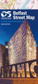
Stadsplattegrond 1 Belfast Street Map | Ordnance Survey (9781905306756)
- ISBN / CODE: 9781905306756
- Editie: 04-12-2013
- Aantal blz.: 1
- Schaal: 1:12000
- Uitgever: Ordnance Survey
- Soort: Stadsplattegrond
- Taal: Engels
- Hoogte: 27.0 cm
- Breedte: 13.0 cm
- Gewicht: 151.0 g
- Bindwijze: -
- Uitvoering: Papier
- Schrijf als eerste een review
-
€ 19,95
Leverbaar in 3 - 5 werkdagen in huis in Nederland Levertijd Belgie
Gratis verzending in Nederland vanaf €35,-
Beschrijving
Behoorlijk uitgebreide stadsplattegrond van Belfast, de hoofstad van noord Ierland. Met register.
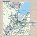
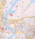
A fully coloured map covering an area of about 12 miles north/south by 8 miles east/west around Belfast, The Greater Belfast street map, is based on our large scale digital database and provides the clearest possible coverage of the city and surrounding area. With this double sided map is a useful booklet containing every street name in the greater Belfast area, with grid references for ease of location.
Reviews
Geen reviews gevonden voor dit product.
Schrijf een review
Graag horen wij wat u van dit artikel vindt. Vindt u het goed, leuk, mooi, slecht, lelijk, onbruikbaar of erg handig: schrijf gerust alles op! Het is niet alleen leuk om te doen maar u informeert andere klanten er ook nog mee!


