Categorieën
Veilig online betalen
Betaal veilig via uw eigen bankomgeving
Fietskaart 36 Cycle Map West Dumfries & Galloway | Sustrans (9781910845165)
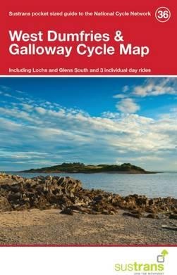
- ISBN / CODE: 9781910845165
- Editie: meest recente versie
- Schaal: 1:110000
- Uitgever: Sustrans
- Soort: Fietskaart
- Serie: Cycle Map
- Taal: Engels
- Uitvoering: Papier
- Bindwijze: -
- Schrijf als eerste een review
-
€ 8,95
Uitverkocht, nooit meer leverbaar
-
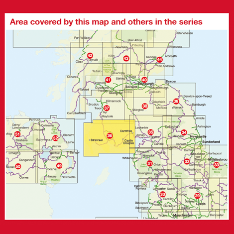
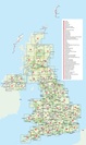
Overzichtskaart Fietskaarten 1:110.000 Engeland, Wales, Schotland en Noord-Ierland | Sustrans
.jpg)
Producten op deze overzichtskaart:
Klik op een product om naar de pagina van dat product te gaan.
Overzichtskaarten
Beschrijving
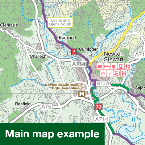
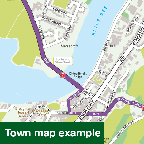
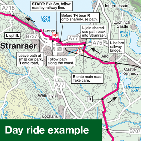
Alle fietsroutes in betreffend gebied staan keurig ingetekend, dus ook die van het National Cycle Network. Ook veel praktische zaken als bezienswaardigheden, stations, supermarkten, fietsenmakers, pubs, hotels etc. Bovendien zijn er drie dagfietstochten op de kaart vermeld.
Reviews
Geen reviews gevonden voor dit product.
Schrijf een review
Graag horen wij wat u van dit artikel vindt. Vindt u het goed, leuk, mooi, slecht, lelijk, onbruikbaar of erg handig: schrijf gerust alles op! Het is niet alleen leuk om te doen maar u informeert andere klanten er ook nog mee!
Ook interessant voor europa/schotland/overig-zuid
-

Wandelgids Walking the Galloway Hill
€ 18,50Wandelgidsen Lowlands | Schotse Laaglanden en grenzen -

Reisgids Slow Travel Dumfries and Ga
€ 20,95Reisgidsen Lowlands | Schotse Laaglanden en grenzen -

Wandelkaart - Topografische kaart 31
€ 19,50Topografische kaarten Lowlands | Schotse Laaglanden en grenzen -

Wegenkaart - landkaart Pocket Map Du
€ 7,95Wegenkaarten Lowlands | Schotse Laaglanden en grenzen -

Wandelkaart - Topografische kaart 33
€ 19,50Topografische kaarten Lowlands | Schotse Laaglanden en grenzen