Categorieën
Veilig online betalen
Betaal veilig via uw eigen bankomgeving
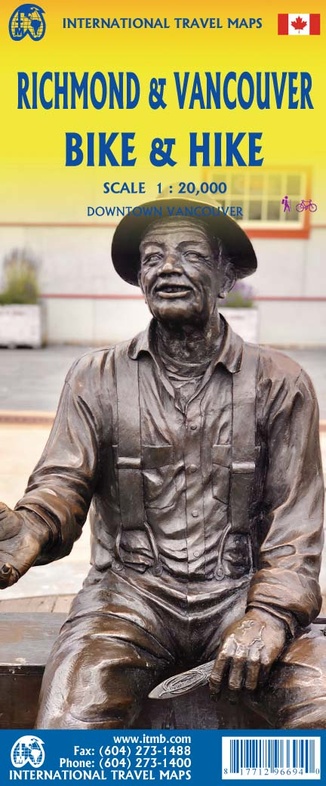
Fietskaart - Wandelkaart Richmond & Vancouver fietsen & wandelen | ITMB (9781771296694)
- ISBN / CODE: 9781771296694
- Editie: 31-05-2022
- Druk: 1
- Aantal blz.: 1
- Schaal: 1:20000
- Uitgever: ITMB
- Soort: Fietskaart, Wandelkaart
- Taal: Engels
- Hoogte: 25.0 cm
- Breedte: 10.0 cm
- Gewicht: 52.0 g
- Uitvoering: Papier
- Bindwijze: -
- Schrijf als eerste een review
-
€ 12,95
Leverbaar in 3 - 5 werkdagen in huis in Nederland Levertijd Belgie
Gratis verzending in Nederland vanaf €35,-
Beschrijving
Van de uitgever
Richmond & Vancouver fiets- & wandelkaart
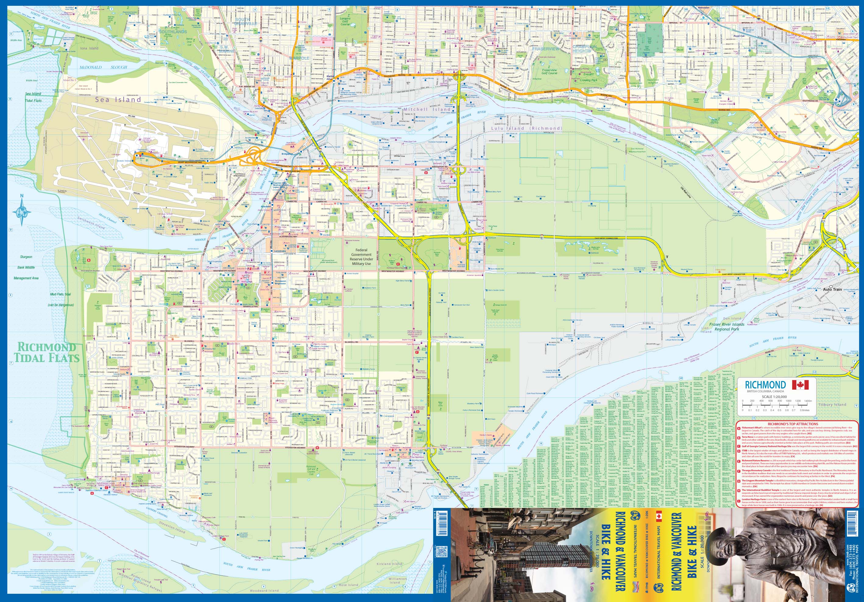
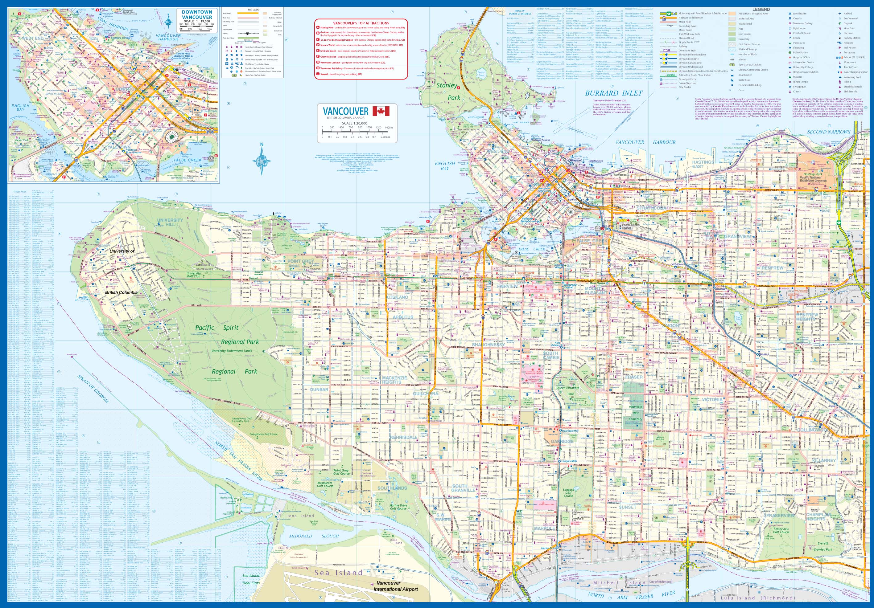
Vancouver consists of 23 municipalities loosely linked together. There is no such thing as Metropolitan Vancouver, but there is a regional council of mayors that co-ordinates water supply and similar features necessary to an overall urban area that stretched for a hundred kilometers and houses two and a half million people. Richmond is an island in the middle of the Fraser River housing the city’s international airport, most of its restaurants, most of Canada’s blueberry crop, and housing for over 200,000 people – and growing. The city has not had a travel map until now, and while the international market potential may seem low, Richmond is more important than one might think. Its YVR international airport is the gateway to Asia, with more flights than any other North American airport. It is the largest Asian city outside of Asia, hosting over 800 restaurants. The Reifel Island Bird Sanctuary is the winter home of 30,000,000 Siberian Snow Geese. Steveston is the west coast’s fishing port and the site of the world’s largest cannery (now a national museum). It is also the home of ITMB, the little company that could. This map is double-sided, with Richmond gracing side A and Vancouver City side B. The map focuses on air, rapid transit, road, bicycle, and pedestrian travel. Naturally, the Vancouver side is more intensely developed, having the university, Pacific Spirit Regional Park, the famous Stanley Park, and the downtown area. The Richmond side focuses on the airport, the protected agricultural lands, and its many hiking & biking trails. We are mapping the Vancouver area one portion at a time, because the urban area is far too spread out to fit on one map. We have had a map of the City of Vancouver for some years, and recently added a title covering the Northshore communities of North and West Vancouver, Mapping Richmond proved to be difficult, because no data base existed, but now it has been done. Lan is now working on the municipalities immediately east of the City
Reviews
Geen reviews gevonden voor dit product.
Schrijf een review
Graag horen wij wat u van dit artikel vindt. Vindt u het goed, leuk, mooi, slecht, lelijk, onbruikbaar of erg handig: schrijf gerust alles op! Het is niet alleen leuk om te doen maar u informeert andere klanten er ook nog mee!
Ook interessant voor noord-amerika/canada/vancouver
-

Reisgids Road Trip USA Vancouver and
€ 23,95Reisgidsen Canadian Rockies & Banff -

Stadsplattegrond Vancouver | Borch
€ 10,25Stadsplattegronden Vancouver -

Wegenkaart - landkaart Vancouver's N
€ 13,95Wegenkaarten British Columbia -

Stadsplattegrond City map Vancouver
€ 9,95Stadsplattegronden Vancouver -

Fietskaart - Wandelkaart North & Wes
€ 13,95Fietskaarten Vancouver