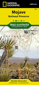
Wandelkaart - Topografische kaart 256 Mojave National Preserve | National Geographic (9781566953832)
- ISBN / CODE: 9781566953832
- Editie: 01-06-2023
- Aantal blz.: 1
- Schaal: 1:125000
- Uitgever: National Geographic
- Soort: Topografische kaart, Wandelkaart
- Taal: Engels
- Hoogte: 24.0 cm
- Breedte: 11.0 cm
- Gewicht: 92.0 g
- Bindwijze: -
- Uitvoering: Scheur- en watervast
- Schrijf als eerste een review
-
€ 17,95
Leverbaar in 3 - 5 werkdagen in huis in Nederland Levertijd Belgie
Gratis verzending in Nederland vanaf €35,-
-
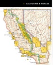
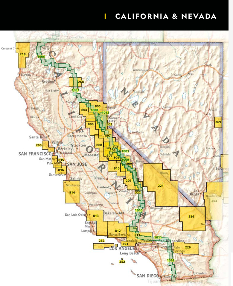
Overzicht Wandelkaarten California Trails Illustrated National Geographic


Producten op deze overzichtskaart:
Klik op een product om naar de pagina van dat product te gaan.
- Wandelatlas - Wandelkaart 1001 John Muir Trail | National Geographic
- Wandelkaart 1006 Pacific Crest Trail: Klamath Mountains /CA | National Geographic
- Wandelkaart 1007 Pacific Crest Trail: Shasta & Lassen /CA | National Geographic
- Wandelkaart 1008 Pacific Crest Trail: Sierra Nevada North | National Geographic
- Wandelkaart - Topografische kaart 205 Sequoia - Kings Canyon National Parks | National Geographic
- Wandelkaart - Topografische kaart 206 Yosemite National Park | National Geographic
- Wandelkaart 218 Redwood National & State Parks | National Geographic
- Wandelkaart - Topografische kaart 221 Trails Illustrated Death Valley National Park | National Geographic
- Wandelkaart - Topografische kaart 226 Joshua Tree National Park | National Geographic
- Wandelkaart - Topografische kaart 256 Mojave National Preserve | National Geographic
- Wandelkaart 268 Lassen Volcanic National Park | National Geographic
- Wandelkaart - Topografische kaart 306 Yosemite SW - Yosemite Valley & Wawona | National Geographic
- Wandelkaart - Topografische kaart 307 Yosemite NW - Hetch Hetchy Reservoir | National Geographic
- Wandelkaart - Topografische kaart 308 Yosemite NE - Tuolumne Meadows and Hoover Wilderness | National Geographic
- Wandelkaart 309 Yosemite SE - Ansel Adams Wilderness | National Geographic
- Wandelkaart - Topografische kaart 803 Lake Tahoe Basin | National Geographic
- Wandelkaart 804 Tahoe National Forest West - Yuba & American Rivers | National Geographic
- Wandelkaart 805 Tahoe National Forest East - Sierra Buttes, Donner Pass | National Geographic
- Wandelkaart - Topografische kaart 809 Mammoth Lakes - Mono Divide - Inyo and Sierra National Forests | National Geographic
- Wandelkaart - Topografische kaart 810 Shaver Lake - Sierra National Forest | National Geographic
- Wandelkaart 811 Angeles National Forest | National Geographic
- Wandelkaart 812 Los Padres National Forest East | National Geographic
- Wandelkaart 814 Big Sur / Ventana Wilderness /CA | National Geographic
Overzichtskaarten
Beschrijving
Prachtige geplastificeerde kaart van het nationaal park. Met alle recreatieve voorzieningen als campsites, maar ook met topografische details en wandelroutes ed. Door uitgekiend kleurgebruik zeer prettig in gebruik. Scheur en watervast!
This beautiful waterproof and tear-resistant map of the Mojave National Preserve is useful for all types of recreational activities. Trails are classified by use - hiking, horse and hike, mountain bike, shared use, or motorized - and includes a trail chart showing trail name, location, and allowed use.
Reviews
Geen reviews gevonden voor dit product.
Schrijf een review
Graag horen wij wat u van dit artikel vindt. Vindt u het goed, leuk, mooi, slecht, lelijk, onbruikbaar of erg handig: schrijf gerust alles op! Het is niet alleen leuk om te doen maar u informeert andere klanten er ook nog mee!


