Categorieën
Veilig online betalen
Betaal veilig via uw eigen bankomgeving
Wandkaarten
Wandkaart kopen? Van landkaarten tot kinderwereldkaarten en prikborden, wij hebben een uitgebreide collectie in onze webshop
Verfraai uw interieur met een wandkaart aan de muur, bijvoorbeeld van uw favoriete vakantiebestemming, of van die bijzondere plaats waar u nog weleens naar terug wilt. Kies bijvoorbeeld voor een landkaart of een wereldkaart. Of voor een handig prikbord of educatieve, speelse kinderwereldkaart.
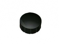 Magneet voor magneetbord 15mm zwart | Maul
Magneetjes waarmee je plekken kunt markeren op het magneetbord. Ze zijn verpakt in een doosje van 10 stuks. Ronde kwaliteitsmagneet. Met sterke oppervlakhechting. kleur: zwart doorsnede: 15 mm
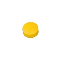 Magneet - handige extra voor magneetbord 15mm geel | Maul
Magneetjes waarmee je plekken kunt markeren op het magneetbord. Ze zijn verpakt in een doosje van 10 stuks. Ronde kwaliteitsmagneet. Met sterke oppervlakhechting. kleur: geel doorsnede: 15 mm
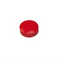 Magneet - handige extra voor magneetbord 15mm rood | Maul
Magneetjes waarmee je plekken kunt markeren op het magneetbord. Ze zijn verpakt in een doosje van 10 stuks. Ronde kwaliteitsmagneet. Met sterke oppervlakhechting. kleur: rood doorsnede: 15 mm
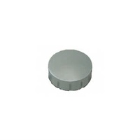 Magneet - handige extra voor magneetbord 15mm grijs | Maul
Magneetjes waarmee je plekken kunt markeren op het magneetbord. Ze zijn verpakt in een doosje van 10 stuks. Ronde kwaliteitsmagneet. Met sterke oppervlakhechting. kleur: grijs doorsnede: 15 mm
 Magneet - handige extra voor magneetbord 15mm Blauw | Maul
Magneetjes waarmee je plekken kunt markeren op het magneetbord. Ze zijn verpakt in een doosje van 10 stuks. Ronde kwaliteitsmagneet. Met sterke oppervlakhechting. kleur: blauw doorsnede: 15 mm
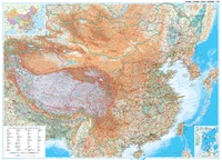 Wandkaart China – geografisch, 120 x 88 cm | Gizi Map
Prachtige wandkaart van China, waarbij zowel de politieke natuurkundige aspecten goed zichtbaar zijn. In rood zijn de belangrijkste toeristische hoogtepunten ingetekend. Kleurgebruik is vrij fel, maar daardoor wordt het geheel …
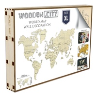
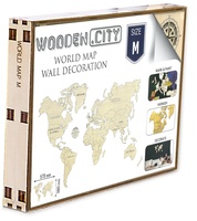 Wereldkaart van hout - Legpuzzel Wooden World Map Medium | Wooden City
De Wooden World Map van Wooden.City is een unieke combinatie van puzzel en wandkaart die prachtig staat in een kinderkamer, woonkamer of studeerkamer. Je kan de houten kaart naar eigen …
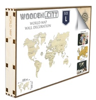 Wereldkaart van hout - Legpuzzel Wooden World Map Large | Wooden City
De Wooden World Map van Wooden.City is een unieke combinatie van puzzel en wandkaart die prachtig staat in een kinderkamer, woonkamer of studeerkamer. Je kan de houten kaart naar eigen …
 Wereldkaart van hout - Legpuzzel Wooden World Map Extra Large | Wooden City
De Wooden World Map van Wooden.City is een unieke combinatie van puzzel en wandkaart die prachtig staat in een kinderkamer, woonkamer of studeerkamer. Je kan de houten kaart naar eigen …
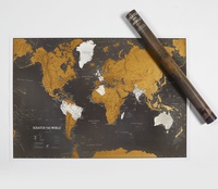
 Scratch Map Scratch Wereldkaart Zwart NEDERLANDS | Maps International
Dit is de nieuwe zwarte editie van de mooie en gedetailleerde kraskaart van Maps International Met deze schitterende scratch map kun je de toplaag van de reeds bezochte bestemmingen …
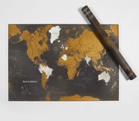
★★★★★ Scratch Map World Map Black Engels | Maps International
Dit is de nieuwe zwarte editie van de mooie en gedetailleerde kraskaart van Maps International Met deze schitterende scratch map kun je de toplaag van de reeds bezochte bestemmingen …
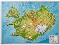 Wandkaart - Reliëfkaart IJsland met voelbaar 3D reliëf 42 x 30 cm | GeoRelief
Prachtig vormgegeven wandkaart van IIsland met reliëf. Uitgevoerd in stevig kunststof is IJsland vanzelfsprekend een land dat zich bij uitstek leent voor een 3D kaart: zo komen de bergmassieven, maar …
★★★★★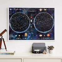 Poster - Wandkaart Stars & constellations glow in the dark 84.1 x 59.4 cm | Maps International
Prachtige glow-in-the-dark wandkaart van het heelal. CONSTELLATIONS MAP POSTER: Glow in the dark poster is packed with illustrated information that includes the planets in our solar system, satellites, lunar positions, …
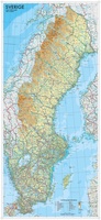 Wandkaart Zweden 55 x 123 cm | Norstedts
Een wandkaart van Zweden in een iets kleiner formaat om aan de muur te hangen. Decoratieve kleuren laten verschillende hoogtelagen zien en maken onder andere de Zweedse bergketen duidelijk. Hoofdwegen, …
★★★★★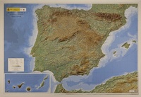 Reliëfkaart Spanje - Península Ibérica, Baleares y Canarias | 127 x 88 cm (9788441656680) | CNIG - Instituto Geográfico Nacional
Reliëfkaart van het Iberisch schiereiland, de Balearen, de Canarische eilanden, Ceuta en Melilla. Het reliëf wordt in 3D, maar ook met schaduw en hoogtekleuren weergegeven. Ook grote steden en grote …
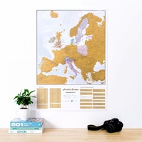 Scratch Map Europa Kraskaart | Maps International
This is a brilliant concept scratch poster of Europe allowing visited destinations to be scratched off revealing the beautifully styled up to date large wall map of Europe underneath. The …
★★★★★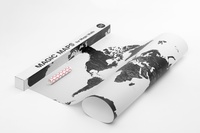 Wereldkaart Magic Map for Magic Walls 140 x 100 cm | Palomar
Simple and sophisticated Palomar’s Magic Maps are world maps that can be attached to a wall magically, without anything to hold them. No glue, no nails, no supports or …
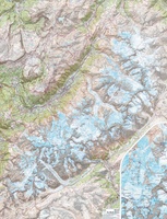 Wandkaart Mont Blanc 100 x 131 cm | IGN - Institut Géographique National
Gelamineerde wandkaart van het Mont Blanc-massief uitgegeven door IGN. Een topografische poster van zeer grote precisie geproduceerd door de gedeeltelijke montage van verschillende TOP 25. Het bevat alle details …
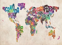 Wereldkaart Text Art 84,1cm x 59,4cm | Maps International
Een andere wereldkaart dan anders. Alle landen zijn weergegeven met hun naam. De kleinere eilanden zoals de Kanarische en een aantal Caribische zijn niet weergegeven. De kaart is gemaakt van …
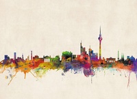 Stadskaart Berlin City Skyline – Berlijn, 84 x 59 cm | Maps International
Een schitterende en kleurrijke aquarel van de skyline van Berlijn. Een aanwinst voor elke muur. A bright and colourful watercolour skyline of the city of Berlin. With bold, dynamic and …
Laatste reviews

We hadden Piëmonte al eens bezocht en voor onze komende reis werd ons door kennissen deze gids aanbevolen. Inderdaad is dit een heel goede gids. …
★★★★★ door DWKdB 19 december 2024 | Heeft dit artikel gekocht
Mijn bestellingen zijn altijd goed en worden altijd op tijd geleverd. Komen afspraken goed na. Erg tevreden.
★★★★★ door Ben Wegdam 19 december 2024 | Heeft dit artikel gekocht
Zeer gedetailleerde kaart van het zuidelijke deel van het douaniers pad
★★★★★ door Marian 18 december 2024 | Heeft dit artikel gekocht
Op eerste zicht heel bruikbare kaart voor verkenning van Corsica
★★★★★ door Alain Maricou 17 december 2024 | Heeft dit artikel gekocht