National Geographic
Dit bekende tv-kanaal heeft naast prachtige natuurdocumontaires en magazines ook zijn eigen reisgidsen en wegenkaarten uitgegeven. De landkaarten zijn gedrukt op scheurvast en waterbestendig papier wat een vergrootte levensduur betekent. De kaarten zijn helder en bevatten een schat aan informatie voor zowel de 'gewone' toerist als de avonturier. De hoofdwegen zijn duidelijk aangegeven, maar ook de secundaire wegen en tracks staan er op. Met de nationale parken duidelijk en mooie zwemplekken of attracties aangegeven onderscheidt deze kaartenserie zich van de andere wegenkaarten. De kaarten heten dan ook niet voor niets Adventure Maps! Het avontuur wacht!
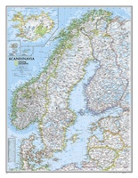 Wandkaart Scandinavië en Ijsland, 60 x 77 cm | National Geographic
National Geographic Wall Maps offer a special glimpse into current and historical events, and they inform about the world and environment. Offered in a variety of styles and formats, these …
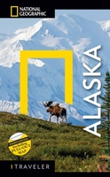 Reisgids Alaska | National Geographic
National Geographic Traveler: Alaska is the travel partner you need to organize a visit to the boundless uncontaminated spaces of "the Great Land" of Alaska, the largest American state, where …
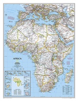 Magneetbord Afrika, politiek, 91 x 118 cm | National Geographic
Mooie wandkaart van Afrika, staatkundig, met rustig kleurgebruik en helder kaartbeeld, Ondanks het wat kleiner formaat staan er toch heel wat topografische details op vermeld. The map presents Africa …
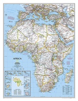 Magneetbord Afrika, politiek, 61 x 78 cm | National Geographic
Mooie wandkaart van Afrika, staatkundig, met rustig kleurgebruik en helder kaartbeeld, Ondanks het wat kleiner formaat staan er toch heel wat topografische details op vermeld. Kaart is up-to-date, alleen …
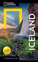 Reisgids IJsland - Iceland | National Geographic
National Geographic Traveler: Iceland is the lighthouse to follow if you do not want to miss anything of the unique and incredible atmosphere, from the northern lights to the capital, …
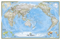 Wereldkaart Politiek, pacific centered, 117 x 78 cm | National Geographic
This unique view employs a new map projection to accentuate the Pacific Rim, and shows Oceania and Asia in close proportion to their actual size on the Earth. It brings …
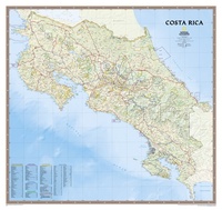 Wandkaart Costa Rica, 97 x 92 cm | National Geographic
Decoratieve wandkaart van Costa Rica. Naast de mooie kleuren staan er bijzonder veel plaatsen op vermeld. This full-color map is a richly detailed rendering of one of Central America's greatest …
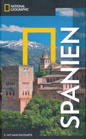 Reisgids Spanien | National Geographic
Duitstalige versie van de National Geographic Spanje Die Höhle von Altamira, das Barri Gòtic in Barcelona, die majestätische Alhambra oder der Palacio Real in Madrid. In Spanien sind die Highlights …
 Reisgids Zonnestelsel | National Geographic
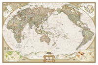 Wereldkaart Politiek & antiek, pacific centered, 117 x 78 cm | National Geographic
National Geographic's World map is the standard by which all other reference maps are measured. The World map is meticulously researched and adheres to National Geographic's convention of making independent, …
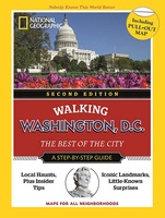 Wandelgids Walking Washington D.C. | National Geographic
Discover the best of Washington, D.C. with this handy guide, through 13 itineraries with step-by-step maps to help you explore its lively, eclectic neighborhoods. In a practical pocket format, the …
 Wegenkaart - landkaart Sierra Nevada | National Geographic
&; Waterproof &; Tear-Resistant &; Travel Map National Geographic's Sierra Nevada Destination Map strikes the perfect balance between map and guidebook and is an ideal resource for touring the …
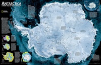 Wandkaart Antarctica Satellite Map, 78 x 50 cm | National Geographic
This digital mosaic of 4,500 satellite scans shows incredible detail of Antarctica's terrain. Includes insets that show the surface elevation, ice sheet thickness, ice flow velocity, and sea ice movement …
★★★★★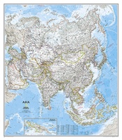 Magneetbord Azië, politiek, 84 x 96 cm | National Geographic
Mooie wandkaart van Azië, staatkundig, met rustig kleurgebruik en helder kaartbeeld, Ondanks het wat kleiner formaat staan er toch heel wat topografische details op vermeld. De kaart wordt in …
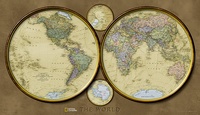 Historische wereldkaart World hemispheres, politiek, 107 x 62 cm | National Geographic
During the 1930s and 1940s, National Geographic designed several world maps using a projection that separated the eastern and western hemispheres. We have brought back this classic view of the …
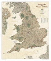 Wandkaart Engeland en Wales, antiek, 76 x 91 cm | National Geographic
This earth-toned, executive-style map of England and Wales shows political boundaries, major highways and roads, cities and towns, airports, and other geographic details. Thousands of place-names and exact borders are …
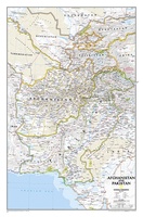 Wandkaart Afghanistan & Pakistan, 55 x 83 cm | National Geographic
This is the latest and most detailed map of the region - a perfect complement for following today's news stories. Afghanistan's 34 administrative provinces and Pakistan's provinces and territorial boundaries …
 Wegenkaart - landkaart Europe - Europa | National Geographic
• Waterproof • Tear-Resistant • Reference Map Expertly researched and designed, National Geographic's Europe Flags & Facts Map is the authoritative map of Europe by which other reference maps …
 Wegenkaart - landkaart South America and Antarctica | National Geographic
• Waterproof • Tear-Resistant • Reference Map Expertly researched and designed, National Geographic's South America and Antarctica Flags & Facts Map is the authoritative map of South America by …
 Wegenkaart - landkaart Asia - Azië | National Geographic
• Waterproof • Tear-Resistant • Reference Map Expertly researched and designed, National Geographic's Asia Flags & Facts Map is the authoritative map of Asia by which other reference maps …
Laatste reviews

Kan de huidige ontstuimige ontwikkelingen wereldwijd, nu ook geografisch plaatsen en daarmee beter volgen.
★★★★★ door Leo Janssen 20 december 2024 | Heeft dit artikel gekocht
We hadden Piëmonte al eens bezocht en voor onze komende reis werd ons door kennissen deze gids aanbevolen. Inderdaad is dit een heel goede gids. …
★★★★★ door DWKdB 19 december 2024 | Heeft dit artikel gekocht
Mijn bestellingen zijn altijd goed en worden altijd op tijd geleverd. Komen afspraken goed na. Erg tevreden.
★★★★★ door Ben Wegdam 19 december 2024 | Heeft dit artikel gekocht
Zeer gedetailleerde kaart van het zuidelijke deel van het douaniers pad
★★★★★ door Marian 18 december 2024 | Heeft dit artikel gekocht


