Categorieën
Veilig online betalen
Betaal veilig via uw eigen bankomgeving
East of England - East Anglia
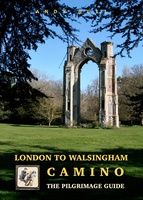 Pelgrimsroute - Wandelgids London to Walsingham Camino | Trailblazer Guides
Full colour, larger format Inspirational guide describing the 13 stages of the pilgrimage route from London to the shrines at Walsingham in Norfolk. The book follows a resurrected route which …
★★★★★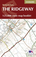 Wandelatlas Ridgeway Map Booklet | Cicerone
Heel handig bedacht van uitgever Cicerone: een boekje dat dienst doet als atlas met alle topografische kaarten die je nodig hebt voor het lopen van de Ridgeway. Past goed in …
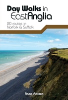 Wandelgids Day Walks East Anglia | Vertebrate Publishing
Day Walks in East Angliafeatures 20 routes between 5.7 and 13.9 miles (9.2km and 22.4km) in length, suitable for hillwalkers of all abilities. Researched and written by outdoor adventure expert …
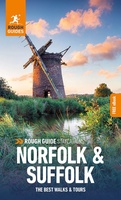 Reisgids Norfolk & Suffolk | Rough Guides
Een kleinere versie in zakformaat van de grotere versies van de Rough Guides. Als altijd weer vol met goede informatie over cultuur en praktische zaken. Voorin een kaart van de …
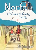 Wandelgids Norfolk | Pocket Mountains
Handige compacte wandelgids met 40 dagwandelingen. Deze gids bevat kleine kaartjes en leuke uitgebreide informatie over wat er langs de route te zien is. Goede wandelkaarten zijn echter we noodzakelijk …
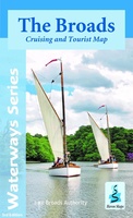 Wandelkaart The Broads | Heron Maps
A full colour map of the Broads suitable for both waterways and leisure users. This map gives detailed coverage of the Broads with emphasis on the waterways and information …
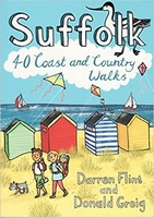 Wandelgids Suffolk : 40 Coast and Country Walks | Pocket Mountains
Handige compacte wandelgids met 40 dagwandelingen. Deze gids bevat kleine kaartjes en leuke uitgebreide informatie over wat er langs de route te zien is. Goede wandelkaarten zijn echter we noodzakelijk …
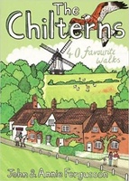 Wandelgids The Chilterns | Pocket Mountains
Handige compacte wandelgids met 40 dagwandelingen. Deze gids bevat kleine kaartjes en leuke uitgebreide informatie over wat er langs de route te zien is. Goede wandelkaarten zijn echter we noodzakelijk …
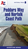 Wandelatlas Adventure Atlas Norfolk Coast Path Peddars Way | A-Z Map Company
AZ heeft de meest gedetailleerde wandelkaarten van het zuidelijke deel van het Lake District gebundeld in een atlasje. Daardoor is het heel handig qua formaat. De kaarten zelf zijn perfect …
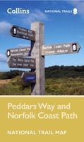 Wandelkaart National Trail Map Peddars Way and Norfolk Coast | Collins
Overzichtskaart op vrij grove schaal van deze LAW Lange Afstands Wandeling in Engeland. Let op: je kunt er niet op lopen. Wel met veel informatie op de kaart, goed ingetekend, …
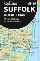 Wegenkaart - landkaart Pocket Map Suffolk | Collins
Explore new places with handy pocket maps from Collins. Handy little full-colour map of county of Suffolk. Detailed mapping, photographs, and tourist information. Famed for its archaeological finds, swathes …
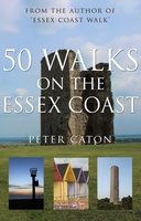 Wandelgids 50 Walks on the Essex Coast | Matador
A walking guide describing 50 walks along the Essex coast, the longest coastline of any English county. Peter Caton discovered the wonderful Essex coastline as he narrated his journey along …
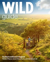 Reisgids London and Southern and Eastern England | Wild Things Publishing
Wild guide Southern and Eastern England is een gids met beschrijvingen en foto's van de mooiste plekken in de vrije natuur in het zuiden en oosten van Engeland. Imagine a summer …
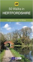 Wandelgids 50 Walks in Hertfordshire | AA Publishing
Uitstekende wandelgids met een aantal dagtochten tussen de 5 en 13 kilometer. Niet heel erg lang dus, maar wel op de mooiste plekken en goed beschreven en prima kaartmateriaal. …
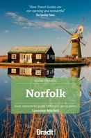 Reisgids Slow Travel Norfolk | Bradt Travel Guides
Een bijzondere serie van Bradt guides, waarin een gedeelte van Engeland of Schotland uitgebreid beschreven wordt. Met veel aandacht voor kleine details die je niet al gauw elders zult vinden. …
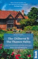 Reisgids Slow Travel The Chilterns & the Thames Valley | Bradt Travel Guides
Een bijzondere serie van Bradt guides, waarin een gedeelte van Engeland of Schotland uitgebreid beschreven wordt. Met veel aandacht voor kleine details die je niet al gauw elders zult vinden. …
★★★★★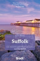 Reisgids Slow Travel Suffolk | Bradt Travel Guides
Een bijzondere serie van Bradt guides, waarin een gedeelte van Engeland of Schotland uitgebreid beschreven wordt. Met veel aandacht voor kleine details die je niet al gauw elders zult vinden. …
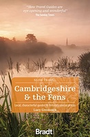 Reisgids Slow Travel Cambridgeshire and the Fens | Bradt Travel Guides
Een bijzondere serie van Bradt guides, waarin een gedeelte van Engeland uitgebreid beschreven wordt. Met veel aandacht voor kleine details die je niet al gauw elders zult vinden. Naast de …
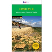 Wandelgids 045 Pathfinder Guides Norfolk | Ordnance Survey
200 miles of inland and coastal walking visiting windpumps and watermills . . . Walk 28 beautiful trails across Norfolk with the OS Pathfinder Guidebooks, graded by length and …
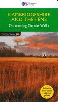 Wandelgids 051 Pathfinder Guides Cambridgeshire & the Fens | Ordnance Survey
Explore 28 beautiful walks across Cambridgeshire and the Fens with the OS Pathfinder Guidebooks, graded by length and ranging from 3 to 11 miles. It is the flattest place …
Laatste reviews

Gebruikt in dec. 2024. Kaart is actueel en goed te gebruiken om te wandelen of te mountainbiken. Kaart met wat vreemde hoogte indicatie waardoor je …
★★★★★ door S 05 januari 2025 | Heeft dit artikel gekocht
De landkaart voldoet geheel aan mijn wensen. Ik zocht en zo klein mogelijke schaal, om onze routes te plannen. Helaas is de eerste bestelling verdwenen …
★★★★★ door Albert Huizing 04 januari 2025 | Heeft dit artikel gekocht
Prachtige foto’s die herkenbaar zijn na een bezoek aan Suriname. Interessante achtergrond informatie. Jammer dat het boek niet meer gedrukt wordt. Snel verstuurd!
★★★★★ door Neeltje 03 januari 2025 | Heeft dit artikel gekocht
Ik kocht dit boek voor pakjesavond voor mijn zwager en schoonzus, die het heerlijk vinden om regelmatig samen te wandelen, ergens in Nederland. Ook houden …
★★★★★ door Cindy de Lange-Wirds 03 januari 2025 | Heeft dit artikel gekocht