Categorieën
Veilig online betalen
Betaal veilig via uw eigen bankomgeving
Wandelgidsen - Wales
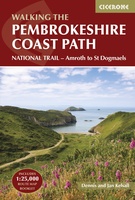 Wandelgids Walking the Pembrokeshire Coast Path | Cicerone
Engelstalige beschrijving van een mooie wandeltocht in Wales. De gids voldoet aan alle verwachtingen die je kunt hebben. Met apart gidsje met prima wandelkaarten. This guidebook describes the Pembrokeshire Coast …
★★★★★ Wandelgids Mountain walking Snowdonia | Cicerone
Uitstekende wandelgids voor dit uitdagende wandelgebied in Wales. 38 dagtochten en een tweedaagse tocht. This guidebook describes 40 day walks exploring Snowdonia. It showcases some of the best mountain walks …
 Wandelgids Pembrokeshire Coast Path Wales, St. Dogmaels to Amroth | Aurum Press
Beschrijving van de route langs de kust van Zuidwest Wales. Historische en culturele aspecten komen vrij uitgebreid aan bod, praktische informatie is wel summier. Kaartmateriaal zonder meer uitstekend! The Pembrokeshire …
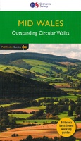 Wandelgids 041 Pathfinder Guides Mid Wales | Ordnance Survey
Wandelgids van midden Wales. Deze gids bevat 28 dagwandelingen, variërend van korte tochten tot pittige dagtochten. De bijbehorende kaarten zijn uitstekend: men heeft de topografische kaarten van Ordnance Survey gebruikt …
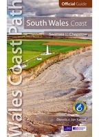 Wandelgids South Wales Coast | Northern Eye Books
The 115 mile/185km long South Wales Coast section of the Wales Coast Path runs through unexpectedly varied and dramatic coastal scenery. Highlights of the route include the historic coastal cities …
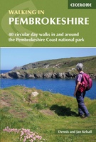 Wandelgids Walking in Pembrokeshire | Cicerone
Uitstekende wandelgids van dit mooie gebied aan de kust van Wales: het Pembrokeshire Coast national park. Goed beschreven met veel praktische informatie om de route te kunnen lopen, inclusief redelijke …
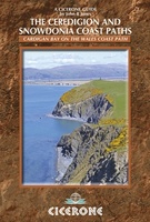 Wandelgids Wales: The Ceredigion and Snowdonia Coast Paths | Cicerone
As part of the Wales Coast Path, the Ceredigion Coast Path and Snowdonia Coast Path trace a curve of 233km (145 miles) of coastal and inland walking down Cardigan Bay. …
 Wandelgids Offa's Dyke Path (Prestatyn - Chepstow) | Aurum Press
Goede beschrijving van de aantrekkelijke route. Kaartmateriaal van Ordnance Survey - de Engelse topografische dienst op een schaal van 1:25.000. Praktische info voor overnachten ed. niet altijd uitgebreid, maar die …
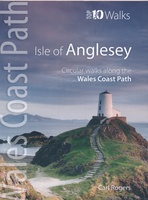 Wandelgids Isle of Anglesey - Wales | Northern Eye Books
Zeer handzaam boekje van een tiental rondwandelingen, met goede kaarten en beschrijving. Leuke toevoeging op de route of als je alleen maar naar die streek gaat en op zoek bent …
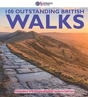 Wandelgids 100 outstanding British Walks | Ordnance Survey
Beschrijving van de 100 mooiste Pathfinder wandelingen in Engeland, Wales en Schotland. Uitstekende beschrijving van de route met een zeer duidelijke topografische kaart waarop de route is ingetekend. This magnificent …
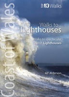 Wandelgids Walks to Lighthouses Wales | Northern Eye Books
Klein, handzaam wandelgidsje met spectaculaire wandelingen naar vuurtorens. Met goede kaartjes van Ordnance Survey. This attractive and cleverly structured guide gives walkers ten of the finest walks to the ten …
 Wandelgids North Wales Coast walks | Northern Eye Books
Zeer handzaam boekje van een tiental rondwandelingen, met goede kaarten en beschrijving. Leuke toevoeging op de route of als je alleen maar naar die streek gaat en op zoek bent …
 Wandelgids Pembrokeshire North - Wales | Northern Eye Books
Zeer handzaam boekje van een tiental rondwandelingen, met goede kaarten en beschrijving. Leuke toevoeging op de route of als je alleen maar naar die streek gaat en op zoek bent …
 Wandelgids Scrambles in Scrambles in Snowdonia | Cicerone
This revised edition of Steve Ashton's classic guide presents 80 scrambles in the stunning Snowdonia National Park, offering challenge, adventure and exhilaration, but also breathtaking scenery and an unparalleled opportunity …
 Wandelgids 055 Pathfinder Guides Gower, Swansea and Cardiff | Ordnance Survey
Wandelgids van een deel van Engeland, Schotland of Wales. Deze gids bevat 28 dagwandelingen, variërend van korte tochten tot pittige dagtochten. De bijbehorende kaarten zijn uitstekend: men heeft de topografische …
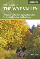 Wandelgids Walking in the Wye Valley | Cicerone
This guidebook includes 30 day walks in the stunning and varied lands of the Wye Valley. From its source on Plynlimon in the Welsh Cambrian mountains, down along the Wales-England …
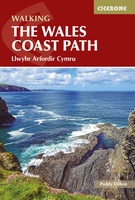 Wandelgids Walking the Wales Coast Path | Cicerone
The Wales Coast Path offers an unparalleled opportunity to walk a nation's coastline in its entirety. Stretching 1400km (870 miles) from Chester to Chepstow, including Anglesey, the waymarked trail takes …
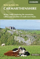 Wandelgids Walking in Carmarthenshire | Cicerone
This guidebook presents 30 contrasting day walks exploring the mountains, valleys and coastline of Carmarthernshire in south-west Wales. Ranging from 2 to 10 miles in length and suitable for walkers …
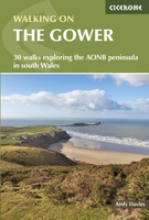 Wandelgids Walking on the Gower | Cicerone
Wandelgids met 30 wandelroutes in het zuiden van Wales This guidebook presents 30 circular day walks across the Gower Area of Outstanding Natural Beauty, taking in the rich variety of …
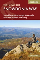 Wandelgids Snowdonia Way | Cicerone
Een beschrijving van de Snowdonia Way, goede beschrijving met gedetailleerd kaartmateriaal..Ook praktische informatie en hoogteprofielen per etappe. This guidebook describes the Snowdonia Way in Wales, a long-distance route through …
Laatste reviews

Super handig fiets boekje en mooi water bestendig. En handig om op de kaarten te kijken heel duidelijk beschrijving. Wij fietsen al jaren in Duitsland …
★★★★★ door Jenneke holterman 19 november 2024 | Heeft dit artikel gekocht
prima kaart levering en betaling allemaal vlot verlopen
★★★★★ door Marc Buts 19 november 2024 | Heeft dit artikel gekocht
Ik heb een uitklapbare kaart van Londen gekocht voor toeristische doeleinden. Snel geleverd en een product die volledig voldoet aan de behoeften. Chapeau!
★★★★★ door Cees Lindenberg 18 november 2024 | Heeft dit artikel gekocht
Mooi stevig, klein koffertje. Ik had eerst de 'middenmaat' besteld maar die was helaas niet meer leverbaar. Snelle en goede communicatie hierover. Het kleinste formaat …
★★★★★ door Marieke 17 november 2024 | Heeft dit artikel gekocht