Categorieën
Veilig online betalen
Betaal veilig via uw eigen bankomgeving
Wegenkaarten - Schotland
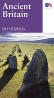 Wegenkaart - landkaart Ancient Britain | Ordnance Survey
The Ordnance Survey Ancient Britain map is a comprehensive guide to the most important archaeological sites of early English, Welsh and Scottish history. Ordnance Survey's Ancient Britain map shows Neolithic, …
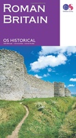 Wegenkaart - landkaart Roman Britain | Ordnance Survey
An informative map showing the location of the most important ancient monuments of Roman Britain. The map has been produced by Ordnance Survey in collaboration with the Ancient Monument Trusts …
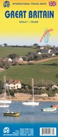 Wegenkaart - landkaart Great Britain - Engeland - Schotland | ITMB
Een degelijke kaart met aanduidingen van o.a. nationale parken, vliegveld, benzinepomp, dirt-roads en kleine plattegrond van hoofdstad. Als overzichtskaart goed te gebruiken. This is the third set of …
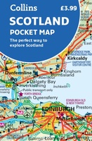 Wegenkaart - landkaart Pocket Map Scotland | Collins
Handy little full colour map of Scotland. Excellent value and very detailed for its size. Double-sided folded map with the Central Belt, southern Scotland and northern England on one side …
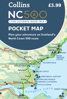 Wegenkaart - landkaart Pocket Map NC500 | Collins
Handy little full colour map of the popular North Coast 500 route. A perfect guide for travelling around Northern Scotland. Detailed mapping and tourist information ideal for any road trip. …
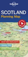 Wegenkaart - landkaart Planning Map Scotland - Schotland | Lonely Planet
Durable and waterproof, with a handy slipcase and an easy-fold format, Lonely Planet's Scotland Planning Map helps you get around with ease. Get more from your map and your …
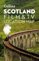 Wegenkaart - landkaart Pocket Map Scotland Film and TV Location Map | Collins
Full-colour, handy guide to more than 60 of the most popular film and TV locations in Scotland. Striking images and detailed descriptions allow for a comprehensive guide to Scotland's most …
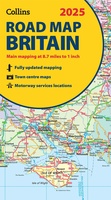 Wegenkaart - landkaart Road Map of Britain 2025 | Collins
Full-colour, double-sided road map of Great Britain at a scale of 8.7 miles to 1 inch. Northern England, Scotland and the Isle of Man are on one side with Southern …
 Wegenkaart - landkaart Touring Map of Scotland - Schotland | Collins
Best-selling map of Scotland. More than 1,000 places of tourist interest plotted and named on the map. The features have been plotted onto an up-to-date and attractive Collins map of …
★★★★★ Wegenkaart - landkaart Scotland - Schotland road map 2025 | Collins
Explore Scotland with easy-to-read mapping from Collins. Full-color map of Scotland at 8.7 miles to 1 inch (1:550.000), with clear road network and administrative areas shown in color. The map …
 Wegenkaart - landkaart Islay, Jura & Colonsay Tourist Map | Nicolson
Nicolson Digital Tourist Maps are ideal for planning your visit to some of the most beautiful areas of Scotland. Tourist attractions and places are clearly marked. Topography is shown through …
 Wegenkaart - landkaart Grossbritannien, Irland - Groot Britannie, Ierland | Hallwag
Prima kaart van heel Groot Brittannie en Ierland , dubbelzijdig bedrukt met plaatsnamen index. Road map Great Britain / Ireland Road map with transit plans, location index, tourist information and …
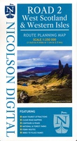 Wegenkaart - landkaart West Scotland - Western ISles - Schotland | Nicolson
Based on the Ordnance Survey 1/250000 Road mapping. Road Map 2 covers West Scotland & the Western Isles. Please scroll through the images to see the area of coverage …
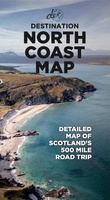 Wegenkaart - landkaart North Coast Road Trip Map | Destination Earth
This North Coast road trip map is the essential tool that will guide you through the breathtaking landscapes, stunning coastal views, and enchanting villages of the North Coast 500 in …
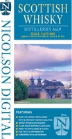 Wegenkaart - landkaart Scottish Whisky Distilleries Map | Schotse whiskystokerijen | Nicolson
Our brand new and up to date whisky map shows over 150 distilleries on our exceptionally clear road mapping, allowing you to navigate to your chosen destination. Enlarged inset map …
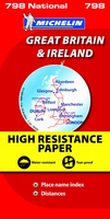 Wegenkaart - landkaart 798 Great Britain & Ireland | Michelin
Scheur- en watervast! Zoals je van Michelin mag verwachten is deze kaart zeer overzichtelijk en heeft een duidelijk helder kaartbeeld. De kaart geeft uitgebreid toeristische informatie weer. Met register, …
 Wegenkaart - landkaart Visitors map Scotland - Schotland | A-Z Map Company
xplore the whole of Scotland from Dumfries and Galloway in the South to the Orkney Islands in the North. With detailed road mapping and illustrated town plans of major cities, …
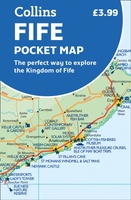 Wegenkaart - landkaart Pocket Map Fife | Collins
Handy little full colour map of the coastal Kingdom of Fife. Detailed mapping and tourist information from Dundee in the North to Edinburgh in the south and from Fife coast …
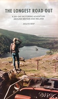 Wegenkaart - landkaart Routemap The Longest Road Out | Longestroadout
Deze kaart hoort bij het boek The Longest Road Out
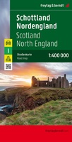 Wegenkaart - landkaart Schotland en Noord Engeland | Freytag & Berndt
Goede tweezijdige wegenkaart van het Noord Engeland en Schotland. Met register en enkele stadsplattegronden. De berijdbare wegen zijn goed weergeven, zowel de hoofdwegen als provinciale en lokale wegen; wegnummers worden …
Laatste reviews

Veel kaarten op stock en gemakkelijk te bestellen. Snel geleverd
★★★★★ door Rob 29 april 2024 | Heeft dit artikel gekocht
We hebben een landkaart van Albanië besteld. Deze hebben we in goede staat ontvangen
★★★★★ door Ida van der Heiden 26 april 2024 | Heeft dit artikel gekocht
Zoals gewend van de Alpverein weer een mooie en duidelijke kaart voor dit mooie wandelgebied incl. hutten.
★★★★★ door B van R 26 april 2024 | Heeft dit artikel gekocht
Duidelijke en mooie kaart van het gebied. Oogt stevig/dik waardoor niet snel kapot tijdens wandelingen. Sommige tekens zijn wel wat aan de kleine kant waardoor …
★★★★★ door B van R 26 april 2024 | Heeft dit artikel gekocht