Wandelkaarten - Schotse Hooglanden & Speyside
Overzichtskaarten
-
Overzichtskaart Explorer 25.000 wandelkaarten Noord Schotland
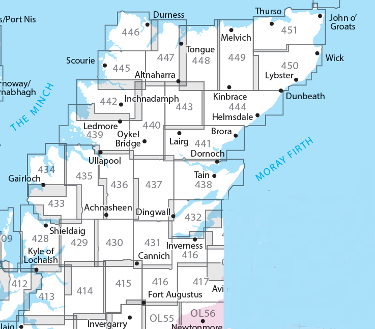
Producten op deze overzichtskaart:
Klik op een product om naar de pagina van dat product te gaan.
- Wandelkaart - Topografische kaart 416 OS Explorer Map Inverness, Loch Ness, Culloden | Ordnance Survey
- Wandelkaart - Topografische kaart 428 OS Explorer Map Kyle of Lochalsh, Plockton, Applecross | Ordnance Survey
- Wandelkaart - Topografische kaart 429 OS Explorer Map Glen Carron, West Monar | Ordnance Survey
- Wandelkaart - Topografische kaart 430 OS Explorer Map Loch Monar, Glen Cannich, Glen Strathfarrar | Ordnance Survey
- Wandelkaart - Topografische kaart 431 OS Explorer Map Glen Urquhart, Strathglass | Ordnance Survey
- Wandelkaart - Topografische kaart 432 OS Explorer Map Black Isle | Ordnance Survey
- Wandelkaart - Topografische kaart 433 OS Explorer Map Explorer Torridon - Beinn Eighe & Liathach | Ordnance Survey
- Wandelkaart - Topografische kaart 434 OS Explorer Map Gairloch / Loch Ewe | Ordnance Survey
- Wandelkaart - Topografische kaart 435 OS Explorer Map An Teallach / Slioch | Ordnance Survey
- Wandelkaart - Topografische kaart 436 OS Explorer Map Beinn Dearg, Loch Fannich | Ordnance Survey
- Wandelkaart - Topografische kaart 437 OS Explorer Map Ben Wyvis, Strathpeffer | Ordnance Survey
- Wandelkaart - Topografische kaart 438 OS Explorer Map Dornoch, Tain | Ordnance Survey
- Wandelkaart - Topografische kaart 439 OS Explorer Map Coigach, Summer Isles | Ordnance Survey
- Wandelkaart - Topografische kaart 440 OS Explorer Map Glen Cassley, Glen Oykel | Ordnance Survey
- Wandelkaart - Topografische kaart 441 OS Explorer Map Lairg, Bonar Bridge, Golspie | Ordnance Survey
- Wandelkaart - Topografische kaart 442 OS Explorer Map Assynt, Lochinver | Ordnance Survey
- Wandelkaart - Topografische kaart 443 OS Explorer Map Ben Kilbreck, Ben Armine | Ordnance Survey
- Wandelkaart - Topografische kaart 444 OS Explorer Map Helmsdale, Strath of Kildonan | Ordnance Survey
- Wandelkaart - Topografische kaart 445 OS Explorer Map Foinaven, Arkle, Kylesku, Scourie | Ordnance Survey
- Wandelkaart - Topografische kaart 446 OS Explorer Map Durness, Cape Wrath | Ordnance Survey
- Wandelkaart - Topografische kaart 447 OS Explorer Map Ben Hope, Ben Loyal, Kyle of Tongue | Ordnance Survey
- Wandelkaart - Topografische kaart 448 OS Explorer Map Strath Naver & Loch Loyal | Ordnance Survey
- Wandelkaart - Topografische kaart 449 OS Explorer Map Strath Halladale & Strathy Point | Ordnance Survey
- Wandelkaart - Topografische kaart 450 OS Explorer Map Wick, The Flow Country | Ordnance Survey
- Wandelkaart - Topografische kaart 451 OS Explorer Map Thurso, John o' Groats | Ordnance Survey
-
Overzichtskaart Explorer 25.000 wandelkaarten Noordoost Schotland - Cairngorms
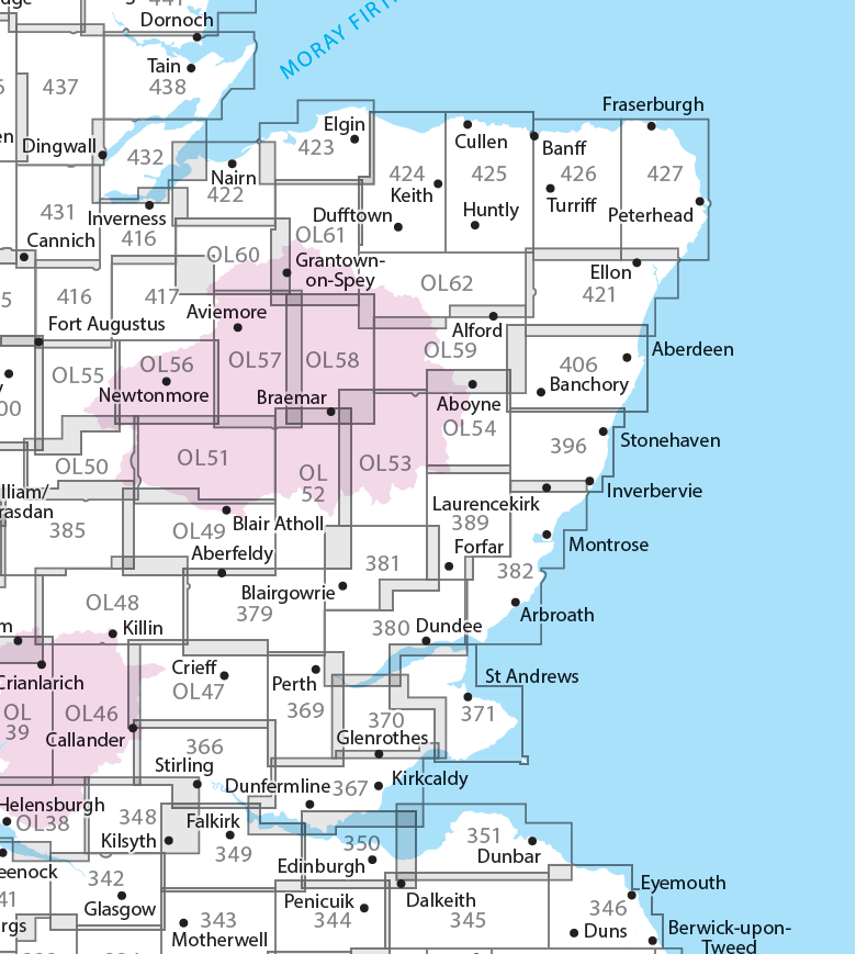
Producten op deze overzichtskaart:
Klik op een product om naar de pagina van dat product te gaan.
- Wandelkaart - Topografische kaart 342 OS Explorer Map Glasgow | Ordnance Survey
- Wandelkaart - Topografische kaart 348 OS Explorer Map Campsie Fells | Ordnance Survey
- Wandelkaart - Topografische kaart 349 OS Explorer Map Falkirk, Cumbernauld, Livingston | Ordnance Survey
- Wandelkaart - Topografische kaart 350 OS Explorer Map Edinburgh | Ordnance Survey
- Wandelkaart - Topografische kaart 351 OS Explorer Map Dunbar, North Berwick | Ordnance Survey
- Wandelkaart - Topografische kaart 366 OS Explorer Map Stirling, Ochil Hills West | Ordnance Survey
- Wandelkaart - Topografische kaart 367 OS Explorer Map Dunfermline, Kirkcaldy, Glenrothes South | Ordnance Survey
- Wandelkaart - Topografische kaart 369 OS Explorer Map Perth, Kinross | Ordnance Survey
- Wandelkaart - Topografische kaart 370 OS Explorer Map Glenrothes North, Falkland, Lomond Hills | Ordnance Survey
- Wandelkaart - Topografische kaart 371 OS Explorer Map St-Andrews, East Fife | Ordnance Survey
- Wandelkaart - Topografische kaart 379 OS Explorer Map Dunkeld, Aberfeldy, Glen Almond | Ordnance Survey
- Wandelkaart - Topografische kaart 380 OS Explorer Map Dundee, Sidlaw Hills | Ordnance Survey
- Wandelkaart - Topografische kaart 381 OS Explorer Map Blairgowrie, Kirriemuir, Glamis | Ordnance Survey
- Wandelkaart - Topografische kaart 382 OS Explorer Map Arbroath, Montrose, Carnoustie | Ordnance Survey
- Wandelkaart - Topografische kaart 385 OS Explorer Map Rannoch Moor, Ben Alder | Ordnance Survey
- Wandelkaart - Topografische kaart 389 OS Explorer Map Forfar, Brechin, Edzell | Ordnance Survey
- Wandelkaart - Topografische kaart 396 OS Explorer Map Stonehaven, Inverbervie & Laurencekirk | Ordnance Survey
- Wandelkaart - Topografische kaart 406 OS Explorer Map Aberdeen, Banchory | Ordnance Survey
- Wandelkaart - Topografische kaart 416 OS Explorer Map Inverness, Loch Ness, Culloden | Ordnance Survey
- Wandelkaart - Topografische kaart 417 OS Explorer Map Monadhliath Mountains North, Strathdearn | Ordnance Survey
- Wandelkaart - Topografische kaart 421 OS Explorer Map Ellon & Inverurie, explorer | Ordnance Survey
- Wandelkaart - Topografische kaart 422 OS Explorer Map Nairn, Cawdor | Ordnance Survey
- Wandelkaart - Topografische kaart 423 OS Explorer Map Elgin, Forres, Lossiemouth | Ordnance Survey
- Wandelkaart - Topografische kaart 424 OS Explorer Map Buckie, Keith | Ordnance Survey
- Wandelkaart - Topografische kaart 425 OS Explorer Map Huntly, Cullen | Ordnance Survey
- Wandelkaart - Topografische kaart 426 OS Explorer Map Banff, Macduff, Turriff | Ordnance Survey
- Wandelkaart - Topografische kaart 427 OS Explorer Map Peterhead, Fraserburgh | Ordnance Survey
- Wandelkaart - Topografische kaart 431 OS Explorer Map Glen Urquhart, Strathglass | Ordnance Survey
- Wandelkaart - Topografische kaart 432 OS Explorer Map Black Isle | Ordnance Survey
- Wandelkaart - Topografische kaart OL46 OS Explorer Map The Trossachs | Ordnance Survey
- Wandelkaart - Topografische kaart OL47 OS Explorer Map Crieff, Comrie & Glen Artney | Ordnance Survey
- Wandelkaart - Topografische kaart OL48 OS Explorer Map Ben Lawers & Glen Lyon | Ordnance Survey
- Wandelkaart - Topografische kaart OL49 OS Explorer Map Pitlochry & Loch Tummel | Ordnance Survey
- Wandelkaart - Topografische kaart OL50 OS Explorer Map Ben Alder, Loch Ericht & Loch Laggan | Ordnance Survey
- Wandelkaart - Topografische kaart OL51 OS Explorer Map Atholl | Ordnance Survey
- Wandelkaart - Topografische kaart OL52 OS Explorer Map | Active Glen Shee - Braemar | Ordnance Survey
- Wandelkaart - Topografische kaart OL53 OS Explorer Map Lochnagar, Glen Muick & Glen Clova | Ordnance Survey
- Wandelkaart - Topografische kaart OL54 OS Explorer Map Glen Esk & Glen Tanar | Ordnance Survey
- Wandelkaart - Topografische kaart OL55 OS Explorer Map Loch Laggan & Creag Meagaidh | Ordnance Survey
- Wandelkaart - Topografische kaart OL56 OS Explorer Map Badenoch & Upper Strathspey | Ordnance Survey
- Wandelkaart - Topografische kaart OL57 OS Explorer Map Cairn Gorm & Aviemore | Ordnance Survey
- Wandelkaart - Topografische kaart OL58 OS Explorer Map Braemar, Tomintoul & Glen Avon | Ordnance Survey
- Wandelkaart - Topografische kaart OL59 OS Explorer Map Aboyne, Alford & Strathdon | Ordnance Survey
- Wandelkaart - Topografische kaart OL60 OS Explorer Map Lochindorb, Grantown-on-Spey & Carrbridge | Ordnance Survey
- Wandelkaart - Topografische kaart OL61 OS Explorer Map Grantown-on-Spey & Hills of Cromdale | Ordnance Survey
- Wandelkaart - Topografische kaart OL62 OS Explorer Map Coreen Hills & Glenlivet | Ordnance Survey
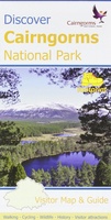 Wandelkaart Discover Cairngorms National Park | Footprint maps
Since it was created in 2003 the Cairngorms National Park has provided the ultimate destination for visitors in the UK wanting to experience a unique mixture of wilderness and cultural …
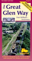 Wandelkaart The Great Glen Way | Footprint maps
The complete map/guide of both routes between Fort William and Inverness. Also contains compact and concise practical information for walkers. For every copy of this map sold, a …
 Wandelkaart Jura - Schotland | Harvey Maps
Shows the Paps of Jura and includes 1 Corbett and 2 Grahams. This detailed map for hillwalkers shows the whole of the Isle of Jura at the popular 1:25,000 …
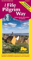 Wandelkaart The Fife Pilgrim Way | Footprint maps
A handy, waterproof map breaking down the Fife Pilgrim Way into seven sections. The Fife Pilgrim Way runs between North Queensferry or Culross and St Andrews. It is designed as …
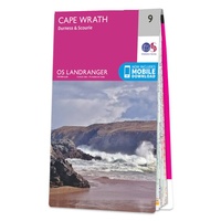 Wandelkaart - Topografische kaart 009 Landranger Cape Wrath - Durness & Scourie | Ordnance Survey
Zeer goede detailkaart met topografische ondergrond. Kleurgebruik is goed over nagedacht: bijzonder goed leesbaar en helder kaartbeeld. Hierop zijn toeristische symbolen van bezienswaardigheden ingetekend, daarnaast staan bijvoorbeeld campings en jeugdherbergen …
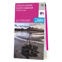 Wandelkaart - Topografische kaart 010 Landranger Strathnaver - Bettyhill & Tongue | Ordnance Survey
Zeer goede detailkaart met topografische ondergrond. Kleurgebruik is goed over nagedacht: bijzonder goed leesbaar en helder kaartbeeld. Hierop zijn toeristische symbolen van bezienswaardigheden ingetekend, daarnaast staan bijvoorbeeld campings en jeugdherbergen …
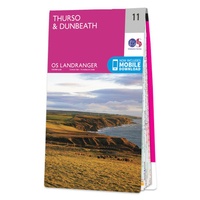 Wandelkaart - Topografische kaart 011 Landranger Thurso & Dunbeath | Ordnance Survey
Zeer goede detailkaart met topografische ondergrond. Kleurgebruik is goed over nagedacht: bijzonder goed leesbaar en helder kaartbeeld. Hierop zijn toeristische symbolen van bezienswaardigheden ingetekend, daarnaast staan bijvoorbeeld campings en jeugdherbergen …
 Wandelkaart John O'Groats trail | Harvey Maps
Mooie, duidelijke kaart van de John O'Groats trail in Schotland. Geplastificeerd met veel extra informatie en uitsnedes van de route. The John o' Groats Trail is a 237 km (147 …
★★★★★★★★★★ Wandelkaart East Highland Way | Harvey Maps
Mooie, duidelijke kaart van de East highland Way in Engeland. Geplastificeerd met veel extra informatie en uitsnedes van de route. East Highland Way is an exciting new unofficial long distance …
★★★★★ Wandelkaart Affric Kintail Way | Harvey Maps
Mooie, duidelijke kaart van de Affric Kintail way in Schotland. Geplastificeerd met veel extra informatie en uitsnedes van de route. De hele rote op 1 kaart, erg handig! The Affric …
★★★★★ Wandelkaart West Highland Way | Harvey Maps
Wandelkaart van de West Highland Way met uitsnedes van de route. Leap forward in technical excellence. Tough, light and 100% wateproof. Compact and light - the map itself weighs just …
★★★★★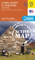 Wandelkaart 57 OS Explorer Map | Active Cairn Gorm, Aviemore ACTIVE | Ordnance Survey
Met zijn 4cm voor 1 km (2 ½ cm voor 1 mijl) schaal, is de OS Outdoor Leisure kaartenserie de ideale en meest gedetailleerde kaartenreeks voor mensen die graag outdoor-activiteiten …
★★★★★ Wandelkaart Glen Coe | Harvey Maps
Includes Buachaille Etive Mor, the Three Sisters of Glen Coe and Bidean nam Bian. Detailed map for hillwalkers of Glen Coe and the Aonach Eagach ridge at the popular …
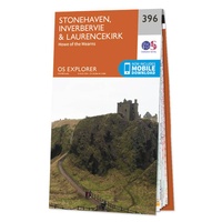 Wandelkaart - Topografische kaart 396 OS Explorer Map Stonehaven, Inverbervie & Laurencekirk | Ordnance Survey
Met zijn 4cm voor 1 km (2 ½ cm voor 1 mijl) schaal, is de OS Explorer kaartenserie de ideale en meest gedetailleerde kaartenreeks voor mensen die graag outdoor-activiteiten zoals …
 Wandelkaart Ben Alder | Harvey Maps
Superwalker is designed to be the most practical tool for navigation outdoors. The Superwalker XT25 is based on original HARVEY mapping with all the information a walker would expect on …
 Wandelkaart Fannichs Seana Bhraigh & Ben Wyvis | Harvey Maps
Detailed map for hillwalkers of the Fannichs ridge at the popular 1:25,000 scale. This is an area located to the south of Ullapool and to the west of Dingwall. Includes …
 Wandelkaart Rum, Eigg, Canna, Muck | Harvey Maps
More than "just" a map, this map is an essential piece of equipment, this new generation of HARVEY Superwalkers is designed to be the most practical tool for navigation outdoors. …
 Wandelkaart Suilven / Stac Pollaidh & Ben More Assynt harve | Harvey Maps
Suilven covers the spectacular group of remote northerly munros popular with walkers and climbers. The map area includes Suilven, Canisp, CulMor,Breabag Stac Pollaidh, Conival & Ben More Assynt. This map …
 Wandelkaart Knoydart / Kintail / Glen Shiel harvey | Harvey Maps
This remote and beautiful area is often known as 'Scotland's last wilderness'. Detailed map for hillwalkers of Knoydart and Glen Shiel at the popular scale of 1:25,000. Includes …
 Wandelkaart Pitlochry Loch Tummel & Blair Atholl | Harvey Maps
Detailed map for hillwalkers of Pitlochry, Loch Tummel and Blair Atholl at the popular 1:25,000 scale. Includes Ben Vrackie, Beinn a’ Ghlo and Pass of Killiecrankie. Shows Aberfeldy in …
Laatste reviews

Kan de huidige ontstuimige ontwikkelingen wereldwijd, nu ook geografisch plaatsen en daarmee beter volgen.
★★★★★ door Leo Janssen 20 december 2024 | Heeft dit artikel gekocht
We hadden Piëmonte al eens bezocht en voor onze komende reis werd ons door kennissen deze gids aanbevolen. Inderdaad is dit een heel goede gids. …
★★★★★ door DWKdB 19 december 2024 | Heeft dit artikel gekocht
Mijn bestellingen zijn altijd goed en worden altijd op tijd geleverd. Komen afspraken goed na. Erg tevreden.
★★★★★ door Ben Wegdam 19 december 2024 | Heeft dit artikel gekocht
Zeer gedetailleerde kaart van het zuidelijke deel van het douaniers pad
★★★★★ door Marian 18 december 2024 | Heeft dit artikel gekocht


