Categorieën
Veilig online betalen
Betaal veilig via uw eigen bankomgeving
Engeland
 Wegenkaart - landkaart Great Britain OS route | Ordnance Survey
Tweezijdige overzichtskaart van heel Engeland en Schotland. Goed duildelijk leesbaar kaartbeeld met de doorgaande en grotere wegen. Ook Nationsle Parken staan er goed op. Ordnance Survey's double-sided OS Route Map …
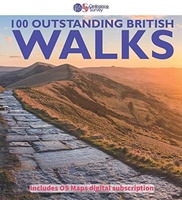 Wandelgids 100 outstanding British Walks | Ordnance Survey
Beschrijving van de 100 mooiste Pathfinder wandelingen in Engeland, Wales en Schotland. Uitstekende beschrijving van de route met een zeer duidelijke topografische kaart waarop de route is ingetekend. This magnificent …
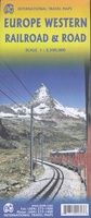 Spoorwegenkaart Europe Western Railroad & Road | ITMB
Spoorwegen kaart van West Europa in kleur. Schaal 1:2,500,000. Toont spoorlijnen, snelwegen, secundaire wegen en andere wegen, veerboten en belangrijke scheepvaartdiensten; internationale grenzen, de grenzen van de gebieden met reisbeperkingen; …
★★★★★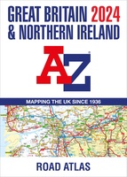 Wegenatlas Great Britain and Northern Ireland Road Atlas 2024 | A-Z Map Company
A full-colour, paperback road atlas of Great Britain, now fully revised and updated. Clear detailed road mapping at a scale of 3.5 miles to 1 inch. Presented in a large, …
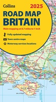 Wegenkaart - landkaart Road Map of Britain 2025 | Collins
Full-colour, double-sided road map of Great Britain at a scale of 8.7 miles to 1 inch. Northern England, Scotland and the Isle of Man are on one side with Southern …
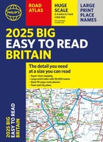 Wegenatlas Philip's Easy to Read Road Atlas of Britain 2025 | A3-Formaat | Paperback | Philip's Maps
With the detail you need at a size you can read, the latest edition of 2025 Philip's Big Easy to Read Road Atlas of Britain is super-clear, super-sized and bang …
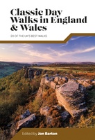 Wandelgids Day Walks Classic Day Walks in England & Wales | Vertebrate Publishing
Classic Day Walks in England & Wales features a selection of 20 of the best day-length hillwalking routes from Vertebrate Publishing's popular series of walking guidebooks. Edited by Jon Barton, …
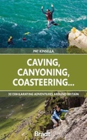 Reisgids Caving, Canyoning, Coasteering | Bradt Travel Guides
You don't need to be ultra-fit or highly experienced in the outdoors to enjoy outdoor guru Patrick Kinsella's selection of 30 activities across Britain. 'A sense of adventure and an …
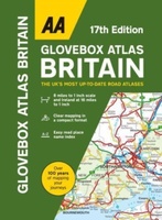 Wegenatlas AA Glovebox Atlas Britain | AA Publishing
This handy atlas fits in the glovebox of your car, perfect for quick referencing on the move. The clear mapping includes a range of essential motoring and useful touring information …
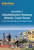 Fietsgids Bikeline Eurovelo 1 - Atlantikküsten - Atlantic Coast Route | Esterbauer
Das Radreisen ist nun schon seit Jahrzehnten eine beliebte Artsich im Urlaub fortzubewegen und erfreut sich immer größererPopularität. Es gibt unzählige Radfernwege und Radregionen,die ein unbeschwertes Radeln ermöglichen. Die Vielfaltist …
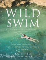 Reisgids Wild Swim | Guardian Faber Publishing
In this stunning and inspiring guide, Kate Rew, founder of the Outdoor Swimming Society, takes you on a wild journey across Britain, braving the elements to experience first-hand some of …
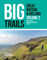 Wandelgids Big Trails Great Britain & Ireland Volume 2 | Vertebrate Publishing
Big Trails: Great Britain and Ireland Volume 2 is the second volume of this inspirational guide to the most iconic long-distance trails in England, Scotland, Wales, Ireland and the Channel …
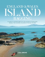 Reisgids England and Wales Island Bagging | Vertebrate Publishing
England & Wales Island Bagging by Lisa Drewe is a stunning and informative guide to the islands of England, Wales, the Channel Islands and the Isle of Man. It is …
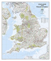 Wandkaart Engeland en Wales, 76 x 92 cm | National Geographic
This classic-style map of England and Wales shows political boundaries, major highways and roads, cities and towns, airports, and other geographic details. Thousands of place-names and exact borders are carefully …
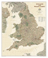 Wandkaart Engeland en Wales, antiek, 76 x 91 cm | National Geographic
This earth-toned, executive-style map of England and Wales shows political boundaries, major highways and roads, cities and towns, airports, and other geographic details. Thousands of place-names and exact borders are …
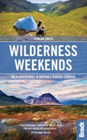 Reisgids Great British Wilderness Weekends - Engeland en Schotland | Bradt Travel Guides
Prachtige reisgids met veel ideeen om er een mooi weekend van te maken! Bed down among some of the most dramatic landscapes in the world and discover your own bolthole …
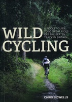 Fietsgids Wild Cycling | Little Brown
Compacte gids met 50 fietsroutes in de Britse wildernis. Met aanduiding van de moeilijkheid, hoogteprofielen en beschrijvingen van de fietstochten. Het kaartmateriaal is wel erg beperkt. Here is plenty …
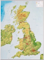 Reliëfkaart Great Britain & Ireland - Groot Brittannië & Ierland | GeoRelief
De uitgever van de kaart is de bekende Duitse uitgever GeoRelief. Deze topografische kaart van Groot Brittannië heeft een hoge kwaliteit met prachtige kleuren. De kaart bevat de namen van …
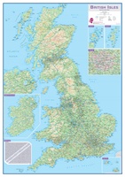 Wandkaart Engeland - British Isles roadplanning wall map, 84 X 119 cm | Maps International
Routeplanner map from Maps International's selection of British Isles maps. Routeplanning map details: British Isles routeplanning map shows the motorways, major roads and transport hubs such as airports and …
 Accommodatiegids Cool Places | Punk Publishing
A lavish full-colour guide to the very best places to stay in the UK: everything from boutique hotels and designer B&Bs to chic country cottages and luxury glampsites. Inspired by …
Laatste reviews

Duidelijke kaart, ook met kleinere wegen. Snelle levering
★★★★★ door Ger Sulkers 02 mei 2024 | Heeft dit artikel gekocht
Ja wij zijn tevreden, alleen is mijn vriendin het boekje al kwijtgeraakt bij onze eerste wandeling.🙁
★★★★★ door Mark 02 mei 2024 | Heeft dit artikel gekocht
Ja ik ben dik tevreden over de wegenkaart van Kazachstan. Stond alles op wat ik wou dus heel erg tevreden daarover.
★★★★★ door Sjoerd Westra 02 mei 2024 | Heeft dit artikel gekocht
Zoals altijd mooie verzorgde kaarten die tijdens de reis van pas komen en achteraf mooie herinneringen oproepen.
★★★★★ door Klaas Wijnberg 02 mei 2024 | Heeft dit artikel gekocht