Schotland
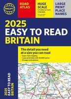 Wegenatlas Easy to Read Road Atlas Britain 2025 | Philip's Maps
"The detail you need at a size you can read". The latest 2025 Philip's Easy to Read Road Atlas of Britain from the best-selling Road Atlas range has over 350 …
★★★★★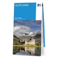 Wegenkaart - landkaart 12 Tour Map Scotland | Ordnance Survey
If you are on holiday and looking for a simple map containing all the information you need to make the most of your visit, the Tour maps are for you. …
★★★★★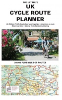 Fietskaart The Ultimate UK Cycle Route Planner | Excellent Books
Fully updated and revised 4th edition for 2022 with an increased sheet size. One of the best selling UK cycle publications giving an overview of all the main signed UK …
★★★★★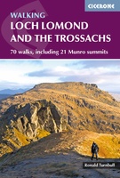 Wandelgids Walking Loch Lomond and The Trossachs | Cicerone
Uitstekende wandelgids, sommige meerdaags, voor dit uitdagende wandelgebied in Schotland. Guidebook to over 70 walking routes in the hills of Loch Lomond and the Trossachs National Park in Scotland's Southern …
★★★★★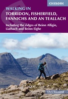 Wandelgids Walking in Torridon, Fisherfield, Fannichs and An Teallach | Cicerone
Guide to 50 walks and easy scrambles in north-western Scotland, covering Southern Torridon, Northern Torridon, Letterewe and Fisherfield, and the Fannichs. Ascents of 27 Munros, 20 Corbetts and 14 Grahams …
 Campinggids Tiny Campsites in Engeland, Schotland en Wales | AA Publishing
Eindelijk een gids voor de echte kampeerder in Engeland, Schotland en Wales: prettig kleine kampeerplekken in de middle of nowhere. We’ve all been there. You venture out into the countryside …
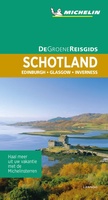 Reisgids Michelin groene gids Schotland | Lannoo
- Betrouwbaar, zowel bij de voorbereiding thuis als op reis - De beroemde sterrenbeoordeling geeft aan wat je moet hebben gezien. - Rijk geïllustreerd met kleurenfoto's - Met tips voor …
★★★★★★★★★★ Wandelkaart West Highland Way | Harvey Maps
Wandelkaart van de West Highland Way met uitsnedes van de route. Leap forward in technical excellence. Tough, light and 100% wateproof. Compact and light - the map itself weighs just …
★★★★★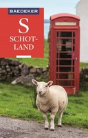 Reisgids Schotland | Baedeker NL
Een Nederlandstalige versie van de beroemde Baedeker reisgids: zeer gedegen, veel informatie en achtergronden, met veel kaartjes en illustraties. Echt een lust voor het oog en ook nog eens één …
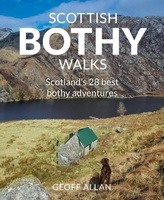 Wandelgids Scottish Bothy Walks | Wild Things Publishing
Scottish Bothy Walks is the sequel to the best-selling Scottish Bothy Bible and describes 28 sensational walking adventures to Scotland’s finest bothies. Choosing his favourite bothies as the focal point, …
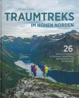 Wandelgids - Fotoboek Traumtreks im hohen Norden | Bruckmann Verlag
Bijzonder mooi inspiratieboek met een beschrijving van 26 mooie wandelroutes in Groenland, Schotland, Scandinavië en in de Baltische Staten: een groot gebied, maar het boek dient dan ook vooral als …
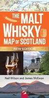 Wegenkaart - landkaart Malt Whisky Map of Scotland | Waverley Books
Een bijzondere kaart van Schotland met alle whisky distilleerderijen in het land weergegeven. The Malt Whisky Map of Scotland is a special map designed by Neil Wilson and James …
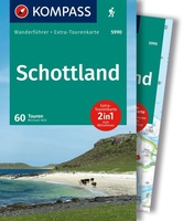 Wandelgids 5990 Wanderführer Schottland - an den Küsten und in den Highlands - Schotland | Kompass
Goede Duitstalige wandelgids met heldere beschrijvingen van de wandeltochten. Met hoogteprofiel, kaartje en de benodigde praktische informatie als bijvoorbeeld de startlocatie met GPS coordinaten. De wandelingen zijn ingedeeld in zwaarte …
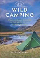 Campinggids Wild Camping UK and Ireland | Conway
Als je echt op zoek bent naar bijzondere kampeerplekken in Engeland, Schotland en Ierland dan is dit je boek: het beschijft de meest afgelegen plekkenin het wild waar je je …
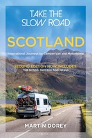 Campergids Take the Slow Road: Scotland | Bloomsbury
Taking the slow road is about turning your back on the fast lane to make time for people, places and nature. Stopping to take a breath. Stopping to let the …
 Wegenatlas Glovebox Atlas Scotland - Schotland | AA Publishing
This handy road atlas fits the glovebox of your car, perfect for quick referencing on the move. Including information on route planning, car ferry routes and operators, restricted motorway junctions, …
 Wandelkaart 57 OS Explorer Map | Active Cairn Gorm, Aviemore ACTIVE | Ordnance Survey
Met zijn 4cm voor 1 km (2 ½ cm voor 1 mijl) schaal, is de OS Outdoor Leisure kaartenserie de ideale en meest gedetailleerde kaartenreeks voor mensen die graag outdoor-activiteiten …
★★★★★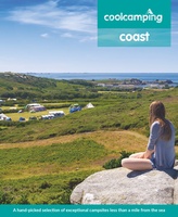 Campinggids - Campergids Cool Camping Coast | Punk Publishing
In recognition of the nation's love for the Great British coastline, 2018 sees the launch of a brand new guidebook - Cool Camping: Coast - the latest title in the …
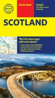 Wegenkaart - landkaart Philip's Scotland Road Map | Philip's Maps
'THE CLEAREST AND MOST DETAILED MAPS OF EUROPE' David Williams MBE, former CEO Gem Motoring Assist The bestselling fold-out road map for navigating in Scotland has been updated for all …
★★★★★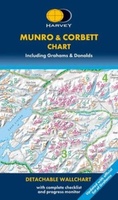 Wandelkaart Munro and Corbett Chart | Harvey Maps
Alle Munro's en Corbetts op 1 kaart! First published in 1996 this current edition of our best selling chart used for monitoring and recording your progress in completing the Munros …
Laatste reviews

Kan de huidige ontstuimige ontwikkelingen wereldwijd, nu ook geografisch plaatsen en daarmee beter volgen.
★★★★★ door Leo Janssen 20 december 2024 | Heeft dit artikel gekocht
We hadden Piëmonte al eens bezocht en voor onze komende reis werd ons door kennissen deze gids aanbevolen. Inderdaad is dit een heel goede gids. …
★★★★★ door DWKdB 19 december 2024 | Heeft dit artikel gekocht
Mijn bestellingen zijn altijd goed en worden altijd op tijd geleverd. Komen afspraken goed na. Erg tevreden.
★★★★★ door Ben Wegdam 19 december 2024 | Heeft dit artikel gekocht
Zeer gedetailleerde kaart van het zuidelijke deel van het douaniers pad
★★★★★ door Marian 18 december 2024 | Heeft dit artikel gekocht


